Filters
No categories available
No brands available
Media
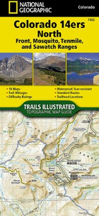
Colorado 14ers North Topographic Map Guide
National GeographicA perfect peakbagger's companion, the Trails Illustrated Colorado 14ers North topographic map guide booklet features details for 14ers of the Front, Mosquito, Tenmile and Sawatch ranges.
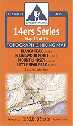
Colorado 14ers Series Map - Blanca Peak, Ellingwood Point, Mount Lindsey, Little Bear Peak
Outdoor Trail MapsMap 13 of 16 in the Colorado 14ers Series covers four 14ers at the southern end of the Sangre de Cristo range, including access from the east or west side, plus hiking trails in the surrounding area.

Colorado 14ers Series Map - Capitol Peak, Snowmass Mountain
Outdoor Trail MapsAre you ready to tackle Capitol Peak's notorious Knife Edge? Map 11 of 16 in the Colorado 14er Series shows you the routes up iconic 14ers Capitol Peak and Snowmass Mountain.
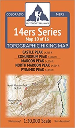
Colorado 14ers Series Map - Castle Peak, Conundrum Peak, Maroon Peak, North Maroon Peak, Pyramid Peak
Outdoor Trail MapsMap 10 of 16 in the Colorado 14ers Series of topographic hiking maps covers 14ers Castle Peak and Conundrum Peak on the front side and Maroon Peak, North Maroon Peak and Pyramid Peak on the back.

Colorado 14ers Series Map - El Diente Peak, Mount Wilson, Wilson Peak, Mount Eolus, North Eolus, Sunlight Peak, Windom Peak
Outdoor Trail MapsGet your 14er fix in Colorado's San Juans with Map 16 of 16 in the Colorado 14ers Series, covering El Diente Peak, Mount Wilson, Wilson Peak, Mount Eolus, North Eolus, Sunlight Peak and Windom Peak.
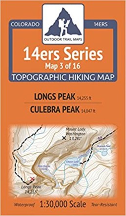
Colorado 14ers Series Map - Longs Peak, Culebra Peak
Outdoor Trail MapsColorado 14ers Series Map 3 of 16 covers 14ers Longs Peak on the front side and Culebra Peak on the back, including all hiking trails in the surrounding areas.
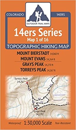
Colorado 14ers Series Map - Mount Bierstadt, Mount Evans, Grays Peak, Torreys Peak
Outdoor Trail MapsEnjoy hiking some of the most popular 14ers and surrounding trails with Colorado 14ers Series Map 1 of 16, covering Mount Evans and Bierstadt on one side and Grays and Torreys Peaks on the other.
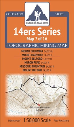
Colorado 14ers Series Map - Mount Columbia, Mount Harvard, Mount Belford, Huron Peak, Missouri Mountain, Mount Oxford
Outdoor Trail MapsGet a good start conquering 14ers in the Collegiate Peaks Wilderness with Map 7 of 16 in the Colorado 14ers Series. It provides topographic maps for hiking 6 famous peaks in this range.
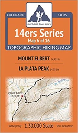
Colorado 14ers Series Map - Mount Elbert, La Plata Peak
Outdoor Trail MapsColorado 14ers Series Map 6 of 16 covers 14ers Mount Elbert on the front side and La Plata Peak on the back, including topographic map coverage of all hiking trails in the surrounding areas.
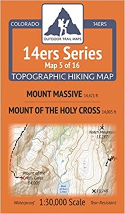
Colorado 14ers Series Map - Mount Massive, Mount of the Holy Cross
Outdoor Trail MapsPlanning to hike Mount Massive or Mount of the Holy Cross? Let Map 5 of 16 in the Colorado 14ers Series lead the way in an easy-to-use format that will stand up to any weather.

Colorado 14ers Series Map - Mount Princeton, Mount Yale
Outdoor Trail MapsNotch a couple "Ivy League" 14ers with Map 8 of 16 in the Colorado 14ers Series. It covers Mount Princeton on the front and Mount Yale on the back, including hiking trails in the surrounding areas.

Colorado 14ers Series Map - Mount Shavano, Tabeguache Peak, Mount Antero
Outdoor Trail MapsThe combo hike up Mount Shavano and neighbor summit Tabeguache lets you knock out two 14ers for the price of one. 14ers Series Map 9 of 16 shows the way—and also features the separate hike up Antero.

Colorado 14ers Series Map - Mount Sneffels, Handies Peak, Redcloud Peak, Sunshine Peak
Outdoor Trail MapsUse this topo map to navigate your way up 4 classic 14ers in the stunning San Juan Mountains—Map 15 of 16 in the Colorado 14ers Series covers Mount Sneffels and Handies, Redcloud and Sunshine Peaks.
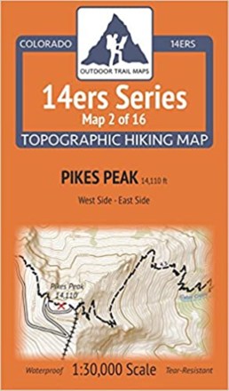
Colorado 14ers Series Map - Pikes Peak
Outdoor Trail MapsColorado 14ers Series map 2 of 16 covers Pikes Peak (west side) on the front of the map and Pikes Peak (east side) on the back, including hiking trails in the surrounding areas.