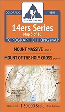

Colorado 14ers Series Map - Mount Massive, Mount of the Holy Cross
Tech Specs
Specifications are maintained on Pack4Back GearDB (community edits and revision history). Values may differ from the manufacturer or your unit—verify before buying.
BrandOutdoor Trail Maps
Best UseHiking
State / ProvinceColorado
Folded Dimensions6.5 x 3.8 x 0.02 inches
Unfolded Dimensions19 x 13 inches
Map Scale1:30,000
Double SidedYes
WaterproofYes
PublisherOutdoor Trail Maps
Copyright Year2017
Map Number5 of 16
Description
Planning to hike Mount Massive or Mount of the Holy Cross? Let Map 5 of 16 in the Colorado 14ers Series lead the way in an easy-to-use format that will stand up to any weather.
Features
- This rugged trail map was designed for on-trail use in the toughest outdoor conditions in a compact and easy-to-fold size—no more fumbling with huge, inaccurate maps
- Shows access to Mount Massive from the North Halfmoon Trailhead and the Colorado Trail, plus North Halfmoon Lakes area and the trails near the Leadville National Fish Hatchery
- The back of the map includes a large section of the Holy Cross Wilderness such as the Notch Mountain Trail, Missouri Lakes Trail and surrounding Missouri Lakes area
- Also includes the Holy Cross City area, the entire Fall Creek Trail, Tuhare Lakes area and the Cross Creek Trail including Missouri Lakes Trailhead and Fancy Creek Trailhead
- Printed on waterproof and tear-resistant material; UTM and GPS compatible
- Part of a beautifully designed series of 16 topographic hiking trails maps, which cover all 58 of Colorado's awe-inspiring 14ers (summits higher than 14,000 ft. elevation)