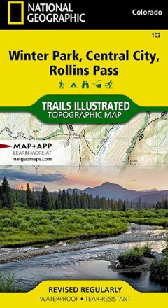
Winter Park/Central City/Rollins Pass Trail Map
National GeographicThis Trails Illustrated folded map offers comprehensive coverage of the Winter Park, Central City and Rollins Pass areas in Colorado.

A Man of the World: My Life at National Geographic
National GeographicAfter six decades at the helm of National Geographic, Gilbert Grosvenor takes readers into his past adventures and lifelong passions in his memoir, A Man of the World.

Absaroka-Beartooth Wilderness East Map
National GeographicThe Trails Illustrated Absaroka-Beartooth Wilderness East map offers comprehensive coverage of this wilderness in south central Montana, home to the state's highest peak.
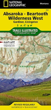
Absaroka-Beartooth Wilderness West Map
National GeographicThe Trails Illustrated Absaroka-Beartooth Wilderness West map offers comprehensive coverage of this wilderness in south central Montana, home to the state's highest peak.
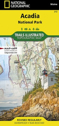
Acadia National Park Trail Map
National GeographicThis beautifully detailed Trails Illustrated map offers comprehensive coverage of Acadia National Park in Maine.
North America MapsNew England and Mid Atlantic Maps - DEPRECATED
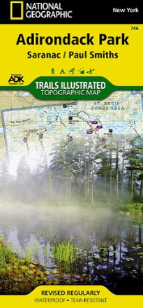
Adirondack National Park Trail Map
National GeographicThis National Geographic Trails Illustrated Adirondack Park trail map offers clear, detailed coverage of Saranac and Paul Smiths areas.
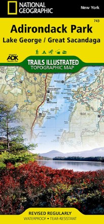
Adirondack Park - Lake George/Great Sacandage Lake Trail Map
National GeographicThis Trails Illustrated folded map offers comprehensive coverage of Adirondack National Park's Lake George and Great Sacandage Lake area in New York.
North America MapsNew England and Mid Atlantic Maps - DEPRECATED
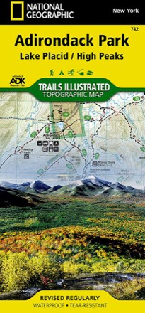
Adirondack Park - Lake Placid/High Peaks Trail Map
National GeographicThis National Geographic Trails Illustrated folded map offers comprehensive coverage of Adirondack Park's Lake Placid and High Peaks in New York.
North America MapsNew England and Mid Atlantic Maps - DEPRECATED
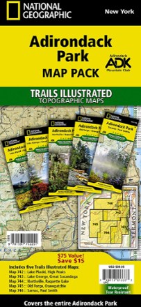
Adirondack Park Topographic Map Pack
National GeographicDesigned to work with Adirondack Mountain Club guidebooks, the Trails Illustrated Adirondack Park topographic map pack features up-to-date trails, mileage, use designations and points of interest.
North America MapsNew England and Mid Atlantic Maps - DEPRECATED
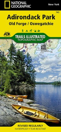
Adirondack Park: Old Forge / Oswegatchie Topographic Map
National GeographicThe Trails Illustrated Adirondack Park: Old Forge / Oswegatchie topographic map combines valuable information with unmatched detail of this beautiful part of New York.
North America MapsNew England and Mid Atlantic Maps - DEPRECATED
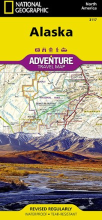
Alaska Adventure Travel Map
National GeographicShowing features across Alaska—from temperate rainforest in the Panhandle to the arctic tundra of the North Slope—the National Geographic Alaska Adventure Travel map helps you plan your adventures.
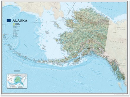
Alaska Wall Map - Tubed
National GeographicOne of the largest and most detailed maps of the entire North Star State, the classic National Geographic Alaska wall map contains beautiful proprietary fonts, bright colors and rich shaded relief.

Alaska's Inside Passage Destination Map
National GeographicThe National Geographic Alaska's Inside Passage Destination map combines a highly detailed shaded relief map of southeast Alaska, complete with visitor and guidebook information.
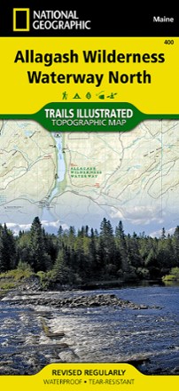
Allagash Wilderness Waterway North Map
National GeographicWhen driving the Maine Scenic Byway, paddling the Northern Forest Canoe Trail or camping in the North Maine Woods, the Trails Illustrated Allagash Wilderness Waterway North map is invaluable.