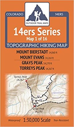
Colorado 14ers Series Map - Mount Bierstadt, Mount Evans, Grays Peak, Torreys Peak
Tech Specs
Specifications are maintained on Pack4Back GearDB (community edits and revision history). Values may differ from the manufacturer or your unit—verify before buying.
BrandOutdoor Trail Maps
Best UseHiking
State / ProvinceColorado
Folded Dimensions6.5 x 3.8 x 0.02 inches
Map Scale1:30,000
Double SidedYes
WaterproofYes
PublisherOutdoor Trail Maps
Copyright Year2017
Map Number1 of 16
Description
Enjoy hiking some of the most popular 14ers and surrounding trails with Colorado 14ers Series Map 1 of 16, covering Mount Evans and Bierstadt on one side and Grays and Torreys Peaks on the other.
Features
- This rugged trail map was designed for on-trail use in the toughest outdoor conditions in a compact and easy-to-fold size—no more fumbling with huge, inaccurate maps
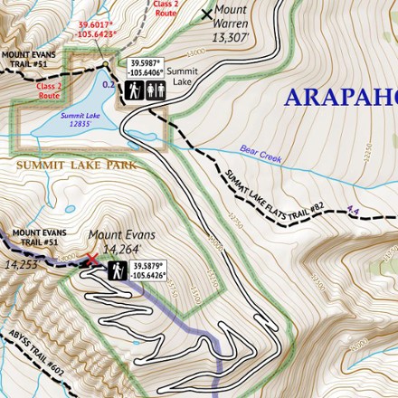
- The front side of Map 1 shows access to Mount Evans via the Mount Evans Toll Road, Summit Lake Park as well as from the Chicago Lakes area via Echo Lake Park
- Mount Bierstadt access is shown from Guanella Pass Trailhead, and trails connecting to Mount Evans and to Summit Lake area are included
- The back of Map 1 shows access to Grays and Torreys Peaks from the north via Grizzly Gulch and Stevens Gulch and from the south via Chihuahua Gulch
- Also included are trails to Mount Sniktau and Grizzly Peak from Loveland Pass, the Lenawee Trail, and a long stretch of the Continental Divide Trail (CDT) over Argentine Pass
- Part of a beautifully designed series of 16 topographic hiking trails maps, which cover all 58 of Colorado's awe-inspiring 14ers (summits higher than 14,000 ft. elevation)
- Printed on waterproof and tear-resistant material; UTM and GPS compatible