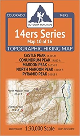

Colorado 14ers Series Map - Castle Peak, Conundrum Peak, Maroon Peak, North Maroon Peak, Pyramid Peak
Tech Specs
Specifications are maintained on Pack4Back GearDB (community edits and revision history). Values may differ from the manufacturer or your unit—verify before buying.
BrandOutdoor Trail Maps
Best UseHiking
State / ProvinceColorado
Folded Dimensions6.5 x 3.8 x 0.02 inches
Unfolded Dimensions19 x 13 inches
Map Scale1:30,000
Double SidedYes
WaterproofYes
PublisherOutdoor Trail Maps
Copyright Year2017
Map Number10 of 16
Description
Map 10 of 16 in the Colorado 14ers Series of topographic hiking maps covers 14ers Castle Peak and Conundrum Peak on the front side and Maroon Peak, North Maroon Peak and Pyramid Peak on the back.
Features
- This rugged trail map was designed for on-trail use in the toughest outdoor conditions in a compact and easy-to-fold size—no more fumbling with huge, inaccurate maps
- Map shows access to Castle and Conundrum Peaks via the 4WD roads from Castle Creek
- Features full coverage of the American Lake Trail, the Cathedral Lake Trail and Cathedral Lake area, and the Electric Pass Trail
- Back of the map shows the entire West Maroon Pass Trail from Maroon Lake Trailhead in the north to the East Fork Trailhead in the south via West Maroon Pass
- Also shows the Crater Lake area, Hasley Basin Trail and Fravert Basin area, Frigid Air Pass and the North Fork Trail
- Includes route difficulty classes for each peak
- Printed on waterproof and tear-resistant material; UTM and GPS compatible
- Part of a beautifully designed series of 16 topographic hiking trails maps, which cover all 58 of Colorado's awe-inspiring 14ers (summits higher than 14,000 ft. elevation)