
Colorado 14ers Series Map - Longs Peak, Culebra Peak
Tech Specs
Specifications are maintained on Pack4Back GearDB (community edits and revision history). Values may differ from the manufacturer or your unit—verify before buying.
BrandOutdoor Trail Maps
Best UseHiking
State / ProvinceColorado
Folded Dimensions6.5 x 3.8 x 0.02 inches
Unfolded Dimensions19 x 13 inches
Map Scale1:30,000
Double SidedYes
WaterproofYes
PublisherOutdoor Trail Maps
Copyright Year2017
Map Number3 of 16
Description
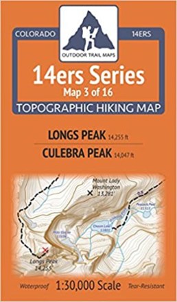
Colorado 14ers Series Map 3 of 16 covers 14ers Longs Peak on the front side and Culebra Peak on the back, including all hiking trails in the surrounding areas.
Features
- Unlike most of the other maps in the 14ers Series, the 14ers on each side of Map 3 are located far across the state from one another
- The front side shows Longs Peak in the Front Range—the northernmost Colorado 14er—along with a large section of the surrounding Rocky Mountain National Park trail system
- This includes access from Longs Peak Trailhead from the east via East Longs Peak Trail
- Also includes access from the north via Bear Lake, Sprague Lake and Bierstadt Lake Trailheads via North Longs Peak Trail, Boulder Brook Trail and Glacier Gorge Trail
- Culebra Peak on the back side of Map 3 is in the Sangre de Cristo Range and is the southernmost 14er in Colorado
- Important note: Culebra Peak is on private property, and any hiking and climbing must be arranged in advance with the land owner (Cielo Vista Ranch)
- Shows the Ranch North Headquarters gate location and coordinates, along with the trailheads and primitive routes to Culebra Peak and nearby Red Mountain
- Printed on waterproof and tear-resistant material; UTM and GPS compatible
- Part of a beautifully designed series of 16 topographic hiking trails maps, which cover all 58 of Colorado's awe-inspiring 14ers (summits higher than 14,000 ft. elevation)