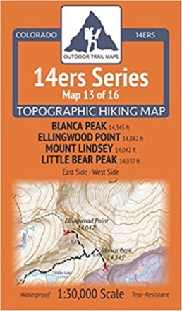

Colorado 14ers Series Map - Blanca Peak, Ellingwood Point, Mount Lindsey, Little Bear Peak
Tech Specs
Specifications are maintained on Pack4Back GearDB (community edits and revision history). Values may differ from the manufacturer or your unit—verify before buying.
BrandOutdoor Trail Maps
Best UseHiking
State / ProvinceColorado
Folded Dimensions6.5 x 3.8 x 0.02 inches
Unfolded Dimensions19 x 13 inches
Map Scale1:30,000
Double SidedYes
WaterproofYes
PublisherOutdoor Trail Maps
Copyright Year2017
Map Number13 of 16
Description
Map 13 of 16 in the Colorado 14ers Series covers four 14ers at the southern end of the Sangre de Cristo range, including access from the east or west side, plus hiking trails in the surrounding area.
Features
- Covers the trails up and around Blanca Peak, Ellingwood Point, Mount Lindsey and Little Bear Peak
- This rugged trail map was designed for on-trail use in the toughest outdoor conditions in a compact and easy-to-fold size—no more fumbling with huge, inaccurate maps
- Front of map features access to Blanca Peak, Ellingwood Point, Mount Lindsey and Little Bear Peak from the north/east via the Huerfano River Valley
- Also shows access from the west via Zapata Falls and the South Zapata Lake Trail
- Back of the map shows access to Blanca Peak, Ellingwood Point and Little Bear Peak via Lake Como Road/Blanca Peak Road
- Note: The summit of Mount Lindsey is on private property, so please ensure respectful usage of the trail and keep it clean of waste so the landowner continues to allow access
- Printed on waterproof and tear-resistant material; UTM and GPS compatible
- Part of a beautifully designed series of 16 topographic hiking trails maps, which cover all 58 of Colorado's awe-inspiring 14ers (summits higher than 14,000 ft. elevation)