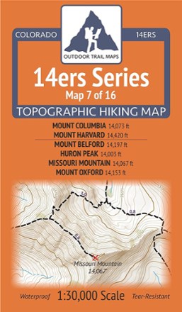

Colorado 14ers Series Map - Mount Columbia, Mount Harvard, Mount Belford, Huron Peak, Missouri Mountain, Mount Oxford
Tech Specs
Specifications are maintained on Pack4Back GearDB (community edits and revision history). Values may differ from the manufacturer or your unit—verify before buying.
BrandOutdoor Trail Maps
Best UseHiking
State / ProvinceColorado
Folded Dimensions6.5 x 3.8 x 0.02 inches
Unfolded Dimensions19 x 13 inches
Map Scale1:30,000
Double SidedYes
WaterproofYes
PublisherOutdoor Trail Maps
Copyright Year2017
Map Number7 of 16
Description
Get a good start conquering 14ers in the Collegiate Peaks Wilderness with Map 7 of 16 in the Colorado 14ers Series. It provides topographic maps for hiking 6 famous peaks in this range.
Features
- This rugged trail map was designed for on-trail use in the toughest outdoor conditions in a compact and easy-to-fold size—no more fumbling with huge, inaccurate maps
- Shows various routes to Mount Columbia and Mount Harvard—via the Horn Fork Basin Trail from the North Cottonwood Trailhead, Frenchman Creek Trail and South Pine Creek Trail
- Also includes Three Elk Trailhead, Frenchmans Trailhead, Wapaca/Lienhart Trailhead, the Harvard Lakes area, Three Elk Trail and South Pine Creek Trail
- Also covers a long stretch of the Colorado Trail north from Cottonwood Creek
- Shows routes to Mount Belford, Huron Peak, Missouri Mountain and Mount Oxford via Missouri Gulch Trailhead, Rockdale Road/Clohesy Lake and South Fork Clear Creek Trailhead
- Also shown are Pear Lake Trail, Three Apostles Trail, Pine Creek Trail and a stretch of the Continental Divide Trail (CDT) along Clear Creek and South Fork Clear Creek
- Printed on waterproof and tear-resistant material; UTM and GPS compatible
- Part of a beautifully designed series of 16 topographic hiking trails maps, which cover all 58 of Colorado's awe-inspiring 14ers (summits higher than 14,000 ft. elevation)