Filters
No categories available
No brands available
Colorado Maps
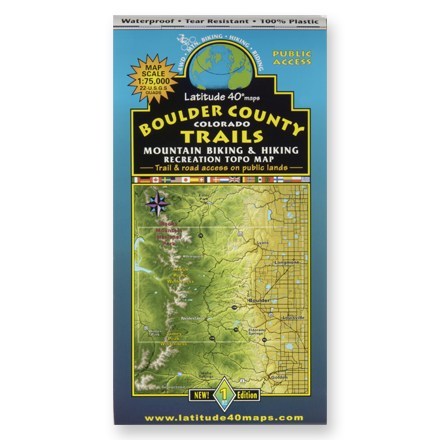
Boulder County Colorado Trails Map
Latitude 40 MapsA waterproof topographic map of Boulder County trails in Colorado for hiking and moutain biking
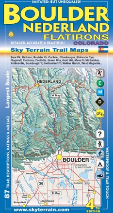
Boulder, Nederland and Flatirons Trail Map - 4th Edition
Sky Terrain Trail MapsVenture into the front range of the Rockies with the Sky Terrain Boulder, Nederland and Flatirons Trail Map, vividly detailed with shade relief topography and an abundance of trails to trek.

Breckenridge Local Trails Map & Guide
National GeographicKnown for world-class skiing, Breckenridge, Colorado, is a true mountain town. Explore its endless adventures with the Breckenridge Local Trails map and guide from National Geographic.

Breckenridge/Tennessee Pass Trail Map
National GeographicThis Trails Illustrated folded map offers comprehensive coverage of the Breckenridge and Tennessee Pass areas in Colorado.
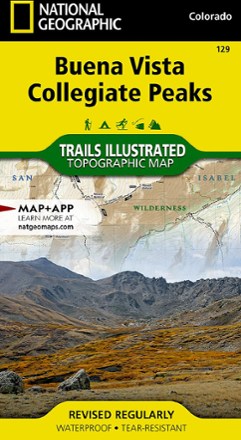
Buena Vista/Collegiate Peaks Trail Map
National GeographicThis National Geographic Trails Illustrated folded map offers comprehensive coverage of Colorado's Buena Vista and Collegiate Peaks.
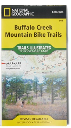
Buffalo Creek Mountain Bike Trails Topographic Map
National GeographicNo matter your skill—novice or rock-hopping daredevil—the Buffalo Creek Mountain Bike Trails topographic map is a detailed resource with ratings, clearly marked track and miles of rides for everyone.
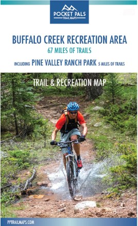
Buffalo Creek Recreation Area Trail and Recreation Map
Pocket Pals Trail MapsPocket-size, durable and detailed, the Pocket Pals Buffalo Creek Recreation Area trail map covers 67 miles of trails, including 5 miles of trails in Pine Valley Ranch Park, and many camping areas.

Buffalo Creek and Waterton Canyon Trail Map - 1st Edition
Sky Terrain Trail MapsVenture just beyond Denver's city limits and into the wilderness with the waterproof, pocket-size Sky Terrain Buffalo Creek and Waterton Canyon Trail Map, filled with an abundance of trails to trek.

Cache La Poudre / Big Thompson Topographic Map
National GeographicOutdoor enthusiasts looking for opportunities just east of Rocky Mountain National Park will find the Trails Illustrated Cache La Poudre / Big Thompson topographic map an essential travel companion.
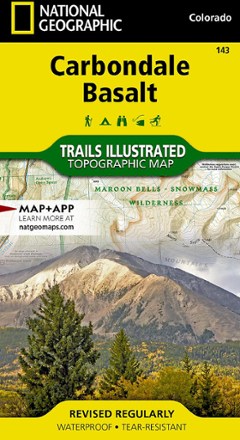
Carbondale/Basalt Trail Map
National GeographicThis National Geographic Trails Illustrated folded map offers comprehensive coverage of Colorado's Carbondale and Basalt.
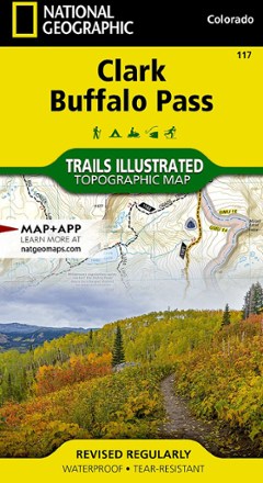
Clark / Buffalo Pass Topographic Map
National GeographicCreated in cooperation with the U.S. Forest Service and other land agencies, the Trails Illustrated Clark / Buffalo Pass topographic map delivers detailed coverage of this region of northern Colorado.

Colorado 14ers - Blanca Peak/Ellingwood Point/Little Bear Peak Trail Map
Pocket Pals Trail MapsPocket-size, durable and detailed, the Pocket Pals Colorado 14ers - Blanca Peak/Ellingwood Point/Little Bear Peak trail map contains detailed info on trailheads and routes for hikers and climbers.
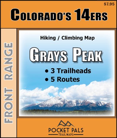
Colorado 14ers - Grays Peak Trail Map
Pocket Pals Trail MapsPocket-size, durable and detailed, the Pocket Pals Colorado 14ers - Grays Peak trail map contains detailed information on 3 trailheads and 5 routes for hikers and climbers.
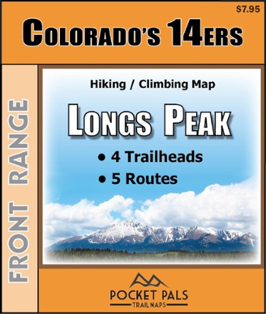
Colorado 14ers - Longs Peak Trail Map
Pocket Pals Trail MapsPocket-size, durable and detailed, the Pocket Pals Colorado 14ers - Longs Peak trail map contains detailed information on 4 trailheads and 5 routes for hikers and climbers.