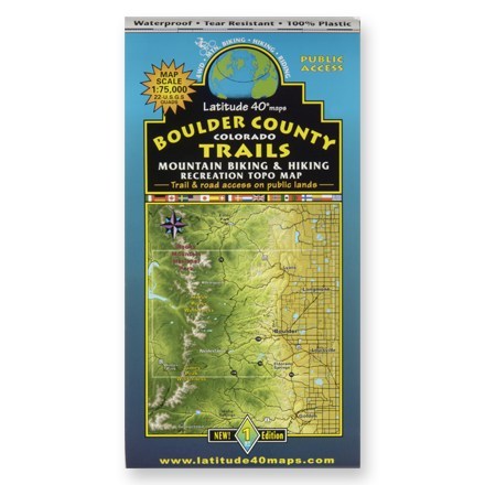
Boulder County Colorado Trails Map
Tech Specs
Specifications are maintained on Pack4Back GearDB (community edits and revision history). Values may differ from the manufacturer or your unit—verify before buying.
Description
A waterproof topographic map of Boulder County trails in Colorado for hiking and moutain biking
Features
- Shows trails, campsites, and recreational features, plus relevant information on wildlife, horse trails, and access for motorized vehicles
- Printed on durable tear-resistant, waterproof material, this map can go virtually anywhere you do
- Brilliantly illustrated topographical representation covers multiple USGS quadrangles, with the convenience of a single map
- Scale to 1:75,000 and contour intervals of 80 feet
- Measures 4 x 9 inches folded, and 28 x 32 inches fully opened
- Published by Latitude 40, Inc.; copyright 2004