Filters
No categories available
No brands available
Southeast Maps Deprecated

Alabama Atlas and Gazetteer
DeLormeFrom the white sands of Dauphin Island to the Walls of Jericho, the DeLorme Alabama Atlas and Gazetteer covers the entire Camellia State in fine detail.

Appalachian Trail Map Pack: Georgia, North Carolina and Tennessee
National GeographicThis Appalachian Trail map pack covers Georgia, North Carolina and Tennessee, tracing the trail from its southern terminus at Springer Mountain to Damascus on the Tennessee/Virginia state line.
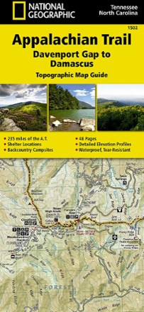
Appalachian Trail: Davenport Gap to Damascus Topographic Map Guide
National GeographicFollow the National Geographic Appalachian Trail: Davenport Gap to Damascus topographic map guide as you take on the northeastern Tennessee and western North Carolina section of the Appalachian Trail.

Appalachian Trail: Springer Mountain to Davenport Gap Topographic Map Guide
National GeographicThe detailed National Geographic Springer Mountain to Davenport Gap topographic map guide covers the Georgia, southeastern Tennessee and southwestern North Carolina sections of the Appalachian Trail.

Black Mountain-Montreat-Ridgecrest Map
Pisgah Map CoFor day hikers and cyclists, grab the Black Mountain map, which will guide you through parks and greenways in town as well as the remote wilds of the Montreat Wilderness and Ridgecrest trail systems.

Brasstown Bald / Chattooga River Topographic Map
National GeographicThe Trails Illustrated Brasstown Bald / Chattooga River topographic map delivers unmatched detail and valuable information to assist you in your exploration of this fascinating area of Georgia.
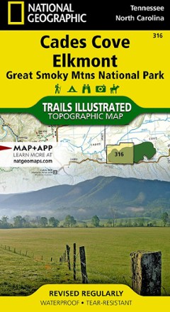
Cades Cove / Elkmont Topographic Map
National GeographicThe Trails Illustrated Cades Cove / Elkmont topographic map covers the western part of Great Smoky Mtns. National Park, from Sugarlands to Chilhowee Mountain and Lake.
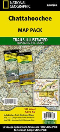
Chattahoochee Topographic Map Pack
National GeographicTrails Illustrated Chattahoochee topographic map pack offers 2 titles for Chattahoochee National Forest, covering the Appalachian Trail's south end and an abundance of recreational opportunities.

Chattooga River Map and Trail Guide
Pisgah Map CoWork your way all along the Chattooga Riber by foot or boat with the Chattooga River map and trail guide as your navigator through these tranquil, free-flowing waters in rugged South Carolina.
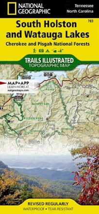
Cherokee and Pisgah National Forests - South Holston and Watauga Lakes Trail Map
National GeographicThis National Geographic Trails Illustrated folded map offers coverage of South Holston and Watauga Lakes in Tennessee and North Carolina.

Cherokee and Pisgah National Forests Topographic Map
National GeographicThe detailed Trails Illustrated Cherokee and Pisgah National Forests topographic map offers concise and colorful coverage of the French Broad and Nolichucky rivers in Tennessee and North Carolina.

Clingmans Dome / Cataloochee Topographic Map
National GeographicThe Trails Illustrated Clingmans Dome / Cataloochee topographic map covers the eastern part of Great Smoky Mountains National park, from Sugarlands to Pisgah National Forest.

Dolly Sods and Seneca Rocks Lizard Map - 2nd Edition
Purple Lizard MapsWhether you're hiking or mountain biking, the Purple Lizard Dolly Sods and Seneca Rocks map helps you cover a lot of ground on numerous trails through West Virginia's beautiful wilderness areas.

Dupont State Recreational Forest Map
Pisgah Map CoFeaturing popular waterfall hikes and 6 mountain biking routes, the easy-to-use Dupont State Recreational Forest map will help you hit the trail and explore Western North Carolina.