

Appalachian Trail: Springer Mountain to Davenport Gap Topographic Map Guide
Tech Specs
Specifications are maintained on Pack4Back GearDB (community edits and revision history). Values may differ from the manufacturer or your unit—verify before buying.
Description
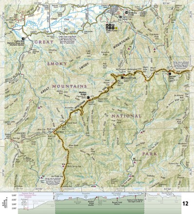
The detailed National Geographic Springer Mountain to Davenport Gap topographic map guide covers the Georgia, southeastern Tennessee and southwestern North Carolina sections of the Appalachian Trail.
Features
- Unique, user-friendly booklet format contains detailed topographic maps centered on the trail, page by page, mile by mile
- Helpful trail profiles show the distance between shelters, camping areas and trail access points
- Features resupply locations, key points of interest, safety guidelines, local contact information, area history and more
- 1:63,360 scale
- Printed in the USA on durable, lightweight, waterproof and tear-resistant material designed to withstand all weather conditions
- Dimensions: 4.25 x 9.25 in.
- National Geographic Maps; copyright 2015