Filters
No categories available
No brands available
New England And Mid Atlantic Maps Deprecated
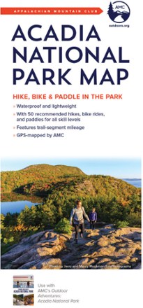
Acadia National Park Map - 4th Edition
AMCExperience the trails, lakes and stellar views of Maine's most popular park with the AMC Acadia National Park map in hand, and use the comprehensive resource to explore by bike, foot or water.
North America MapsNew England and Mid Atlantic Maps - DEPRECATED
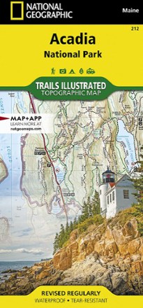
Acadia National Park Trail Map
National GeographicThis beautifully detailed Trails Illustrated map offers comprehensive coverage of Acadia National Park in Maine.
North America MapsNew England and Mid Atlantic Maps - DEPRECATED
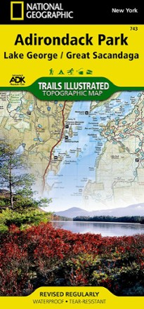
Adirondack Park - Lake George/Great Sacandage Lake Trail Map
National GeographicThis Trails Illustrated folded map offers comprehensive coverage of Adirondack National Park's Lake George and Great Sacandage Lake area in New York.
North America MapsNew England and Mid Atlantic Maps - DEPRECATED
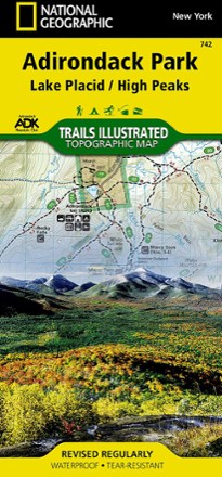
Adirondack Park - Lake Placid/High Peaks Trail Map
National GeographicThis National Geographic Trails Illustrated folded map offers comprehensive coverage of Adirondack Park's Lake Placid and High Peaks in New York.
North America MapsNew England and Mid Atlantic Maps - DEPRECATED

Adirondack Park Topographic Map Pack
National GeographicDesigned to work with Adirondack Mountain Club guidebooks, the Trails Illustrated Adirondack Park topographic map pack features up-to-date trails, mileage, use designations and points of interest.
North America MapsNew England and Mid Atlantic Maps - DEPRECATED
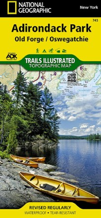
Adirondack Park: Old Forge / Oswegatchie Topographic Map
National GeographicThe Trails Illustrated Adirondack Park: Old Forge / Oswegatchie topographic map combines valuable information with unmatched detail of this beautiful part of New York.
North America MapsNew England and Mid Atlantic Maps - DEPRECATED

Appalachian Trail Map Pack: New Jersey, New York, Connecticut, Massachusetts
National GeographicThis Appalachian Trail map pack covers New Jersey, New York, Connecticut and Massachusetts, following the trail from the Pennsylvania border in the south to the Vermont state line in the north.
North America MapsNew England and Mid Atlantic Maps - DEPRECATED

Appalachian Trail Map Pack: Pennsylvania
National GeographicThe Appalachian Trail (AT) map pack for Pennsylvania covers the entire AT in the Keystone State. These maps follow the ridges of the Appalachian Mountains as the trail weaves in and out of suburbia.
North America MapsNew England and Mid Atlantic Maps - DEPRECATED

Appalachian Trail Map Pack: Vermont and New Hampshire
National GeographicThis Appalachian Trail map pack covers Vermont and New Hampshire—adjacent states with distinctly different landscapes ranging from wooded, rolling terrain to rugged and rocky high country.
North America MapsNew England and Mid Atlantic Maps - DEPRECATED

Appalachian Trail Map Pack: Virginia, West Virginia, Maryland
National GeographicThis Appalachian Trail map pack covers Virginia, West Virginia and Maryland, from the Tennessee/Virginia state line to the southern border of Pennsylvania.
North America MapsNew England and Mid Atlantic Maps - DEPRECATED
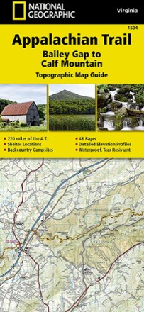
Appalachian Trail: Bailey Gap to Calf Mountain Topographic Map Guide
National GeographicThe National Geographic Appalachian Trail: Bailey Gap to Calf Mountain topographic map guide makes a perfect traveling companion when traversing the central Virginia section of the Appalachian Trail.
North America MapsNew England and Mid Atlantic Maps - DEPRECATED
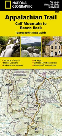
Appalachian Trail: Calf Mountain to Raven Rock Topographic Map Guide
National GeographicInclude the National Geographic Appalachian Trail Calf Mountain to Raven Rock topographic map guide on your list of essentials when thru-hiking the northern Virginia section of the Appalachian Trail.
North America MapsNew England and Mid Atlantic Maps - DEPRECATED
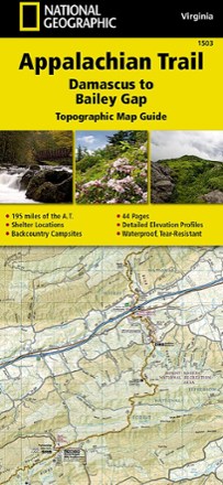
Appalachian Trail: Damascus to Bailey Gap Topographic Map Guide
National GeographicThe National Geographic Appalachian Trail: Damascus to Bailey Gap topographic map guide makes a perfect traveling companion when traversing the southwest Virginia section of the Appalachian Trail.
North America MapsNew England and Mid Atlantic Maps - DEPRECATED
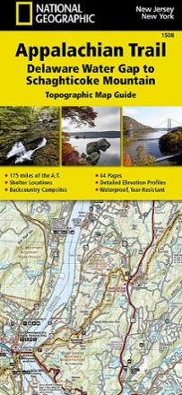
Appalachian Trail: Delaware Water Gap to Schaghticoke Mountain Topographic Map Guide
National GeographicThe National Geographic Appalachian Trail: Delaware Water Gap to Schaghticoke Mountain topographic map guide is a valuable reference for the New Jersey and New York sections of the Appalachian Trail.
North America MapsNew England and Mid Atlantic Maps - DEPRECATED