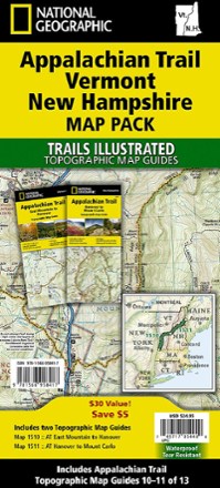


Appalachian Trail Map Pack: Vermont and New Hampshire
Tech Specs
BrandNational Geographic
Best UseBackpacking
Folded Dimensions9.25 x 4.25 x 0.3 inches
Map Scale1:63,360
Double SidedYes
WaterproofYes
PublisherNational Geographic
Copyright Year2020
State / ProvinceConnecticut
Map Number1510-1511
Description
This Appalachian Trail map pack covers Vermont and New Hampshire—adjacent states with distinctly different landscapes ranging from wooded, rolling terrain to rugged and rocky high country.
Features
- The landscape of Vermont is a variety of wooded mountains, forests of white pine and paper birch, and rolling terrain dotted by fields and pastures
- To the north and east, the Appalachian Trail (AT) crosses the short, steep hills and overgrown farmlands that characterize the Connecticut River valley
- Farther south is the rugged and rocky high country of the Green Mountains
- Pack includes 2 detailed topographic map guide booklets centered on the AT and overlapping with adjacent sections to reduce your chances of getting lost
- Built for all levels of hiking enthusiasts—from day-tripper to thru-hiker—these Topographic Map Guides are more convenient and easier to use than folded maps
- Front pages include resupply information, town inset maps, camping options and much more
- Printed on "Backcountry Tough" waterproof, tear-resistant paper with stainless-steel staples
- Along the bottom of each page, a trail profile shows distances between shelters, camping areas, and trail access points
- Map and trail profile provide a step-by-step visual guide to hiking the trail, mile by rugged mile
- A full UTM grid is printed on the map to aid with digital navigation
- Your purchase helps support National Geographic Society nonprofit's mission of research, education, conservation and exploration
- 1:63,360 scale means 1 in. equals 1 mile