Filters
No categories available
No brands available
Mountain West Maps
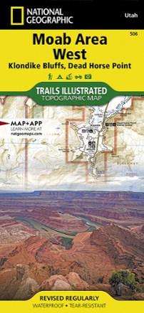
Moab Area West - Klondike Bluffs, Dead Horse Point Map
National GeographicWhether you're going camping, mountain biking, hiking or rafting, the National Geographic Trails Illustrated Moab Area West - Klondike Bluffs, Dead Horse Point map can help you navigate like a pro.

Montana Atlas and Gazetteer - 11th Edition
DeLormeThe DeLorme Montana Atlas and Gazetteer covers Big Sky Country in fine detail, from the mountains that gave this state its name to the plains, buttes and national parks that draw countless visitors.
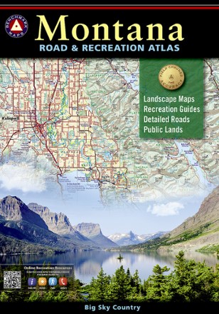
Montana Road & Recreation Atlas - 5th Edition
Benchmark MapsTake the scenic route through the rugged peaks, majestic rivers and expansive plains of Big Sky Country with the 5th edition of Benchmark Maps Montana Road & Recreation Atlas.

Nevada Atlas and Gazetteer
DeLormeFar more than just its most famous towns, the Silver State is host to some exceptional recreation options. Explore them in fine detail with the DeLorme Nevada Atlas and Gazetteer.
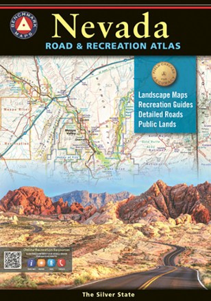
Nevada Road & Recreation Atlas - 8th Edition
Benchmark MapsNevada has long been known as the wildest adventure state in the lower 48, and the Nevada Road & Recreation Atlas aims to corral all of its marvels and outdoor potential.
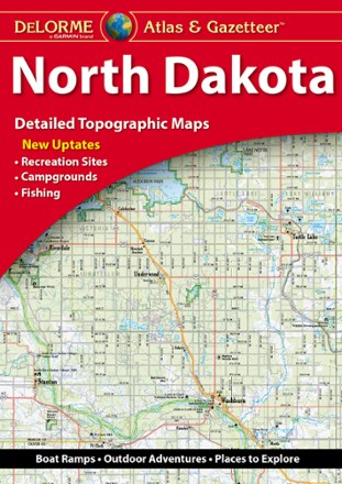
North Dakota Atlas and Gazetteer - 2022 Edition
DeLormeA great companion for outdoor recreation and trip planning, the DeLorme North Dakota Atlas and Gazetteer covers all of the Peace Garden State in fine detail.
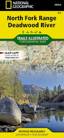
North Fork Range Deadwood River Topographic Map
National GeographicThe expertly researched and highly detailed National Geographic North Fork Range Deadwood River topographic map will aid your Idaho exploration whether you're out on foot, bike, ATV or boat.
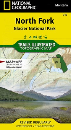
North Fork: Glacier National Park Topographic Map
National GeographicThe Trails Illustrated North Fork: Glacier National Park topographic map will benefit even the most experienced outdoors enthusiast exploring this pristine landscape blessed with very few amenities.
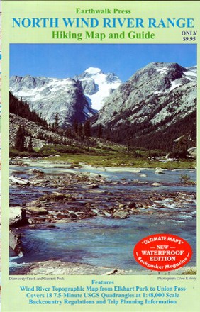
Northern Wind River Range Hiking Map And Guide
Double-sided topographic map covering the northern half of the Wind River Range from Union Pass, WY to Elkhart Park
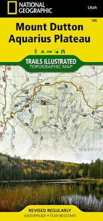
Paunsaugunt Plateau, Mount Dutton & Bryce Canyon Topographic Map
National GeographicFrom Black Butte to Pink Cliffs, journey through southern Utah's dramatic scenery with the National Geographic Paunsaugunt Plateau, Mount Dutton & Bryce Canyon topographic map as your guide.

Rattlesnake Wilderness and Missoula Outdoor Recreation Map
Cairn CartographicsCovering the Rattlesnake Wilderness and prime recreation areas around Missoula, Montana, this Cairn Cartographics map features trail locations and mileages GPS-verified in the summer and fall of 2011.

Red Rock Canyon Adventure Guide
Franko's MapsLocated just 17 miles from the Las Vegas Strip, Red Rock Canyon offers miles of scenic roads and trails and world-class rock climbing. Explore with Franko's Maps Red Rock Canyon Adventure Guide.

San Rafael Swell Trail Map
National GeographicThis beautifully rendered Trails Illustrated folded map offers detailed coverage of Utah's San Rafael Swell area.
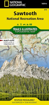
Sawtooth National Recreational Area Topographic Map
National GeographicIdaho's Sawtooth National Recreation Area sports more than 300 high-alpine lakes, 40 peaks over 10,000 ft. and hundreds of miles of trails. Explore it all with this Trails Illustrated topographic map.