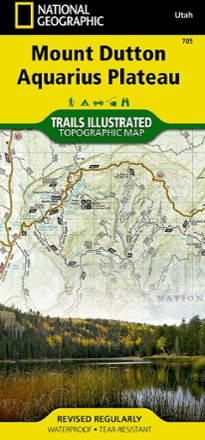


Paunsaugunt Plateau, Mount Dutton & Bryce Canyon Topographic Map
Tech Specs
Specifications are maintained on Pack4Back GearDB (community edits and revision history). Values may differ from the manufacturer or your unit—verify before buying.
BrandNational Geographic
Best UseHiking
State / ProvinceUtah
Folded Dimensions9.25 x 4.25 inches
Unfolded Dimensions37.75 x 25.5 inches
Map Scale1:75,000
Double SidedYes
WaterproofYes
PublisherNational Geographic
Copyright Year2020
Map Number705
Description
From Black Butte to Pink Cliffs, journey through southern Utah's dramatic scenery with the National Geographic Paunsaugunt Plateau, Mount Dutton & Bryce Canyon topographic map as your guide.
Features
- Covers the Powell and Escalante Ranger Districts of Dixie National Forest from Bicknell Bottom State Wildlife Area in the northwest to the town of Panguitch in the southwest
- Includes the Great Western Trail, a corridor of braided trails that form the backbone of Utah's trail system, and the Fremont OHV Trail with diverse terrain and scenery
- Shows Red Canyon Recreation Area where campers can explore the Red Canyon Rim Trail and canoe and fish at Greens Lake
- Includes Box-Death Hollow Wilderness where visitors marvel at the vertical orange sandstone walls cut by tributaries of the Escalante River
- Features Otter Creek State Park, a getaway for birders during spring and fall migrations, ATV riders and boaters
- Maps the dramatic dinosaur-backed Escalante Mountains and the majestic Aquarius Plateau, the highest in North America
- The area offers diverse outdoor recreation including hiking, camping, OHV, canyoneering, bicycling, fishing, hunting, climbing and scenic driving
- Full UTM grid is printed on the map to aid with navigation
- Printed on Backcountry Tough waterproof, tear-resistant paper
- Your purchase helps support National Geographic Society nonprofit's mission of research, education, conservation and exploration