Filters
No categories available
No brands available
Southwest Maps
Mazatzal and Pine Mountain Wilderness Areas Topographic Map
National GeographicOutdoor enthusiasts looking for recreational opportunities just north of Phoenix will marvel at the Trails Illustrated Mazatzal and Pine Mountain Wilderness Areas topographic map.

Mogollon Rim/ Munds Mountain Topographic Map
National GeographicOutdoor enthusiasts seeking recreational opportunities in central Arizona will find the Trails Illustrated Mogollon Rim/ Munds Mountain topographic map an essential travel companion.
New Mexico Recreation Map
Benchmark MapsThe award-winning Benchmark Maps New Mexico recreation map helps you navigate the Land of Enchantment with generous page-to-page overlaps, GPS grids and easy-to-read symbols.
New Mexico Road & Recreation Atlas - 10th Edition
Benchmark MapsJump into the navigator's seat with the Benchmark Maps New Mexico Road and Recreation Atlas and explore the Land of Enchantment with vivid, shade-relief maps and all sorts of recreation to enjoy.
Oklahoma Atlas and Gazetteer
DeLormeSee all the cities and sites across the Sooner State with the DeLorme Oklahoma Atlas and Gazetteer, covering every inch of the 46th state in vivid detail.

Paria Canyon and Kanab Topographic Map
National GeographicThe Trails Illustrated Paria Canyon and Kanab topographic map leads the way to a colorful landscape of sandstone cliffs, slot canyons and winding waterways straddling the border of Arizona and Utah.

Saguaro National Park Map
National GeographicThis National Geographic Trails Illustrated folded map offers comprehensive coverage of Saguaro National Park in Arizona.
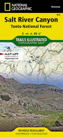
Salt River Canyon Topographic Map
National GeographicCreated in cooperation with the U.S.Forest Service and Bureau of Land Management, the Trails Illustrated Salt River Canyon Topographic Map is an essential companion for your outdoor adventures.

Santa Fe & Bandelier National Monument Trails Map
Map AdventuresFollow trails through historical adobe neighborhoods, forested foothills and high desert mesas with the Santa Fe & Bandelier National Monument Trails Map from Map Adventures.
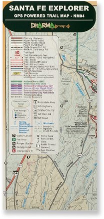
Santa Fe Explorer Trail Map
Discover the splendorous scenery and recreational possibilities around northern New Mexico with the Dharma Maps Santa Fe Explorer trail map, filled with plentiful trails and roads in rich topo detail.

Santa Fe Mountains Waterproof Trail Map
Map AdventuresExperience the outdoor beauty around New Mexico's capital city—an area that boasts an average of 300 days of sunshine a year—with the Map Adventures Santa Fe Waterproof Trail Map as your guide.
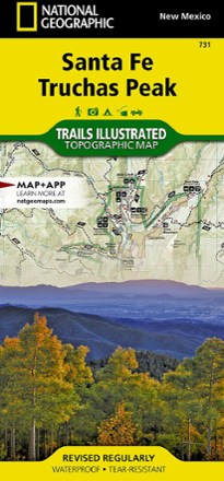
Santa Fe and Truchas Peak Topographic Map
National GeographicThe Trails Illustrated Santa Fe and Truchas Peak topographic map covers Santa Fe's wide range of public recreation lands with unparalleled detail.
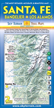
Santa Fe, Bandelier and Los Alamos Trail Map - 2nd Edition
Sky Terrain Trail MapsTrek your way through the vast open spaces, parks, forests and wilderness of New Mexico with the waterproof, pocket-size Sky Terrain Santa Fe Bandelier and Los Alamos Trail Map.

Sedona Singletrack Map
Beartooth PublishingScaled to best show the area's dense trail network, the Beartooth Publishing Sedona Singletrack map includes descriptions for 14 mountain bike rides in one of North America's top MTB destinations.