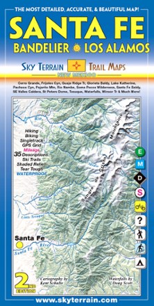
Santa Fe, Bandelier and Los Alamos Trail Map - 2nd Edition
Tech Specs
Specifications are maintained on Pack4Back GearDB (community edits and revision history). Values may differ from the manufacturer or your unit—verify before buying.
Best UseHiking
Folded Dimensions8 x 4 inches
Unfolded Dimensions39 x 24 inches
Map Scale1:35,000; 1:37,500
Double SidedYes
WaterproofYes
PublisherSky Terrain Trail Maps
Copyright Year2012
State / ProvinceNew Mexico
Description
Trek your way through the vast open spaces, parks, forests and wilderness of New Mexico with the waterproof, pocket-size Sky Terrain Santa Fe Bandelier and Los Alamos Trail Map.
Features
- Waterproof, tear-resistant map provides durability in all conditions, and is built to withstand years of use in hand and on the trail
- Covers Santa Fe, Bandelier National Monument, Los Alamos, Southeast Valles Caldera and more
- Color-shaded topographic relief in 80 ft. and 400 ft. contours shows the vivid detail of the stunning terrain
- Full UTM grid makes navigation easy with GPS and compass
- Information includes descriptions to 35 trails, mileage between trail junctions and color-coded difficulty rating symbols to simplify choosing your adventure
- Recreation-focused trails ideal for hiking, mountain biking, skiing, 4WD, motorcycle, camping, fishing and more
- Easy-to-read symbols indicate all campgrounds and trailheads in the area, as well as waterfalls and springs