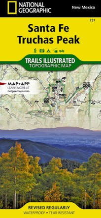

Santa Fe and Truchas Peak Topographic Map
Tech Specs
Specifications are maintained on Pack4Back GearDB (community edits and revision history). Values may differ from the manufacturer or your unit—verify before buying.
Description
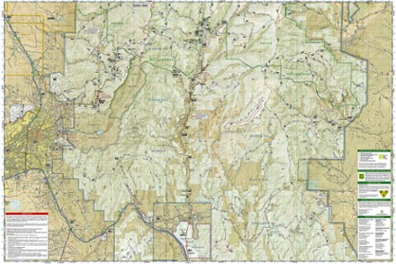
The Trails Illustrated Santa Fe and Truchas Peak topographic map covers Santa Fe's wide range of public recreation lands with unparalleled detail.
Features
- Includes Santa Fe and Carson national forests, Pecos Wilderness and River and National historical parks
- Also includes Picuris, Nambe, Tesuque Pueblos, Morphy Lake and Hyde Memorial state parks, Santa Fe Canyon Preserve and Open Space parks
- Expertly researched and created in cooperation with the U.S. Forest Service and others
- Easy-to-read, yet highly detailed map shows comprehensive trail and road networks, along with designated trails for hiking, horseback riding, biking and more
- Clearly marked navigational aids with UTM coordinate grids, scale bar and full legend, essential for safely navigating the backcountry with GPS or compass
- Key points of interest include scenic views, campgrounds, trail heads, boat launches and picnic sites
- Color-coded boundaries for public lands including national parks, national forests, national monuments, ranger districts, wilderness areas, state parks and wildlife refuges
- Printed in the U.S.A. on a durable, lightweight, waterproof, tear-resistant material designed to withstand all weather conditions
- Folded dimensions: 4.25 x 9.25 in.; unfolded dimensions: 37.75 x 25.5 in.
- 1:63,360 scale
- National Geographic Maps; copyright 2014