Filters
No categories available
No brands available
Southeast Maps
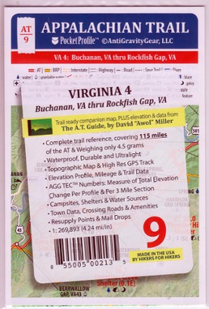
Appalachian Trail Pocket Profile Map: Virginia 4 (Buchanan, VA - Rockfish Gap, VA)
AntiGravityGearWeighing just 4.5g, the AT-9 Appalachian Trail Pocket Profile Map: Virginia 4 from AntiGravityGear is an information-rich strip map to guide you on your AT hike from Buchanan to Rockfish Gap.
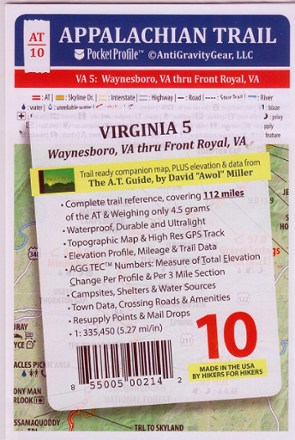
Appalachian Trail Pocket Profile Map: Virginia 5 (Waynesboro, VA - Front Royal, VA)
AntiGravityGearWeighing just 4.5g, the AT-10 Appalachian Trail Pocket Profile Map: Virginia 5 from AntiGravityGear is an information-rich strip map to guide you on your AT hike in Shenandoah National Park.
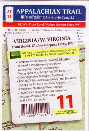
Appalachian Trail Pocket Profile Map: Virginia/W. Virginia (Front Royal, VA - Harpers Ferry, WV)
AntiGravityGearWeighing just 4.5g, the AT-11 Appalachian Trail Pocket Profile Map: Virginia/W. Virginia from AntiGravityGear is an information-rich strip map to guide you on your AT hike in Old Dominion.
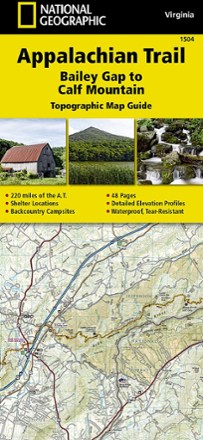
Appalachian Trail: Bailey Gap to Calf Mountain Topographic Map Guide
National GeographicThe National Geographic Appalachian Trail: Bailey Gap to Calf Mountain topographic map guide makes a perfect traveling companion when traversing the central Virginia section of the Appalachian Trail.
North America MapsNew England and Mid Atlantic Maps - DEPRECATED
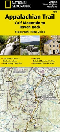
Appalachian Trail: Calf Mountain to Raven Rock Topographic Map Guide
National GeographicInclude the National Geographic Appalachian Trail Calf Mountain to Raven Rock topographic map guide on your list of essentials when thru-hiking the northern Virginia section of the Appalachian Trail.
North America MapsNew England and Mid Atlantic Maps - DEPRECATED
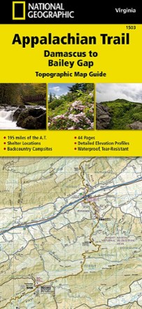
Appalachian Trail: Damascus to Bailey Gap Topographic Map Guide
National GeographicThe National Geographic Appalachian Trail: Damascus to Bailey Gap topographic map guide makes a perfect traveling companion when traversing the southwest Virginia section of the Appalachian Trail.
North America MapsNew England and Mid Atlantic Maps - DEPRECATED
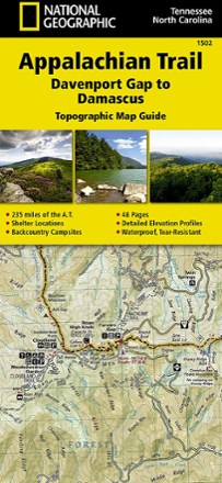
Appalachian Trail: Davenport Gap to Damascus Topographic Map Guide
National GeographicFollow the National Geographic Appalachian Trail: Davenport Gap to Damascus topographic map guide as you take on the northeastern Tennessee and western North Carolina section of the Appalachian Trail.
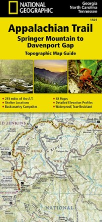
Appalachian Trail: Springer Mountain to Davenport Gap Topographic Map Guide
National GeographicThe detailed National Geographic Springer Mountain to Davenport Gap topographic map guide covers the Georgia, southeastern Tennessee and southwestern North Carolina sections of the Appalachian Trail.
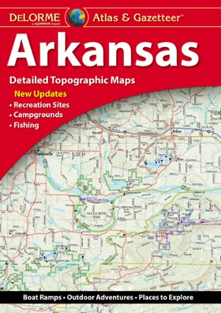
Arkansas Atlas and Gazetteer
DeLormeWhether you're looking for the scenic route or want to discover a new spot to explore, the DeLorme Arkansas Atlas and Gazetteer will be your go-to guide for planning trips around the Natural State.
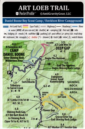
Art Loeb Trail Elevation Profile map
AntiGravityGearWeighing just 4 g, the pocket-size Art Loeb Trail Elevation Profile map from AntiGravityGear is loaded with all at-a-glance information you need for hiking all 30.1 miles of this North Carolina trail.
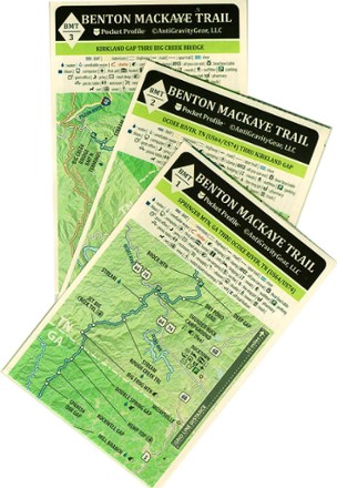
Benton MacKaye Trail Map Set
AntiGravityGearThis Benton MacKaye Trail map set from AntiGravityGear is a backpacker's best friend. Looking to tackle all or part of the Benton MacKaye Trail? You'll want to keep these pocket guides handy.

Big South Fork National Recreation Area Trail Map
National GeographicThis National Geographic Trails Illustrated folded map offers comprehensive coverage of Kentucky's Big South Fork National River and Recreation Area.

Black Mountain-Montreat-Ridgecrest Map
Pisgah Map CoFor day hikers and cyclists, grab the Black Mountain map, which will guide you through parks and greenways in town as well as the remote wilds of the Montreat Wilderness and Ridgecrest trail systems.

Blue Ridge Parkway Destination Map
National GeographicThe National Geographic Blue Ridge Parkway Destination Map guides you along this winding route that traverses some of America's most picturesque scenery.
North America MapsNew England and Mid Atlantic Maps - DEPRECATED