Filters
No categories available
No brands available
Southeast Maps

Alabama Atlas and Gazetteer
DeLormeFrom the white sands of Dauphin Island to the Walls of Jericho, the DeLorme Alabama Atlas and Gazetteer covers the entire Camellia State in fine detail.

Appalachian Trail Map Pack: Georgia, North Carolina and Tennessee
National GeographicThis Appalachian Trail map pack covers Georgia, North Carolina and Tennessee, tracing the trail from its southern terminus at Springer Mountain to Damascus on the Tennessee/Virginia state line.
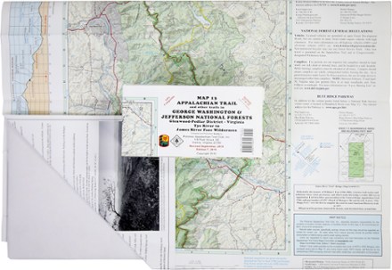
Appalachian Trail Map: AT and Other Trails in George Washington & Jefferson National Forests
PATCThis map covers sections 17 to 22 of the Appalachian Trail in Virginia, from Virginia Tye River to the James River Face Wilderness in the Glenwood-Pedlar District.
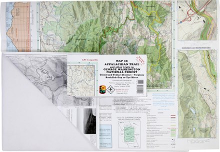
Appalachian Trail Map: AT and Other Trails in George Washington National Forest
PATCReady to explore the wilds of Virginia? The PATC Appalachian Trail Map 12 covers sections 15–17 in VA, from the Virginia Rockfish Gap to Tye River in the Glenwood-Pedlar District.
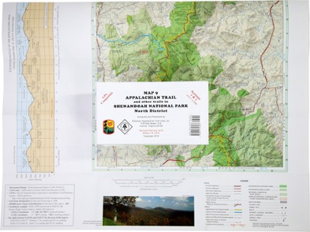
Appalachian Trail Map: AT and Other Trails in Shenandoah National Park North District
PATCThis map covers sections 1 and 2 of the Appalachian Trail—and all side trails—in Shenandoah National Park's North District.
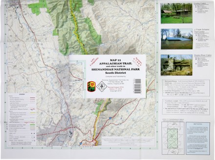
Appalachian Trail Map: AT and Other Trails in Shenandoah National Park South District
PATCThis map covers sections 6, 7, 8 and 9 of the Appalachian Trail—and all side trails—in Shenandoah National Park's South District.
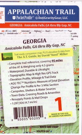
Appalachian Trail Pocket Profile Map: Georgia (Amicalola Falls, GA - Bly Gap, NC)
AntiGravityGearWeighing just 4.5g, the AT-1 Appalachian Trail Pocket Profile Map: Georgia from AntiGravityGear is an information-rich strip map to guide you on your AT hike through the Peach State.
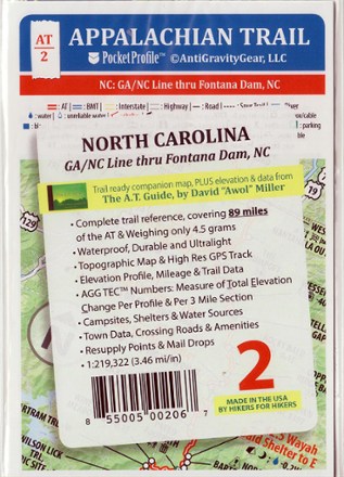
Appalachian Trail Pocket Profile Map: North Carolina (GA/NC Line - Fontana Dam, NC)
AntiGravityGearWeighing just 4.5g, the AT-2 Appalachian Trail Pocket Profile Map: North Carolina from AntiGravityGear is an information-rich strip map to guide you on your AT hike through the Old North State.

Appalachian Trail Pocket Profile Map: North Carolina/Tennessee (Davenport Gap - Erwin, TN)
AntiGravityGearWeighing just 4.5g, the AT-4 Appalachian Trail Pocket Profile Map from AntiGravityGear is an information-rich strip map to guide you on your AT hike from Davenport Gap to Erwin, TN.

Appalachian Trail Pocket Profile Map: North Carolina/Tennessee (Great Smoky Mountains National Park)
AntiGravityGearWeighing just 4.5g, the AT-3 Appalachian Trail Pocket Profile Map: North Carolina/Tennessee from AntiGravityGear is a strip map to guide your hike through Great Smoky Mountains National Park.
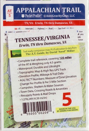
Appalachian Trail Pocket Profile Map: Tennessee/Virginia (Erwin, TN - Damascus, VA)
AntiGravityGearWeighing just 4.5g, the AT-5 Appalachian Trail Pocket Profile Map from AntiGravityGear is an information-rich strip map to guide you on your AT hike from Erwin, TN, to Damascus, VA.
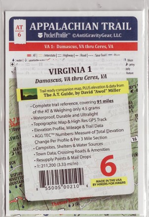
Appalachian Trail Pocket Profile Map: Virginia 1 (Damascus, VA - Ceres, VA)
AntiGravityGearWeighing just 4.5g, the AT-6 Appalachian Trail Pocket Profile Map: Virginia 1 from AntiGravityGear is an information-rich strip map to guide you on your AT hike from Damascus to Ceres.
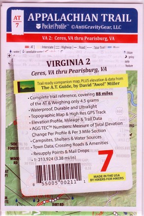
Appalachian Trail Pocket Profile Map: Virginia 2 (Ceres, VA - Pearlsburg, VA)
AntiGravityGearWeighing just 4.5 g, the AT-7 Appalachian Trail Pocket Profile Map: Virginia 2 from AntiGravityGear is an information-rich strip map to guide you on your AT hike from Ceres to Pearlsburg.
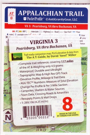
Appalachian Trail Pocket Profile Map: Virginia 3 (Pearlsburg, VA - Buchanan, VA)
AntiGravityGearWeighing just 4.5g, the AT-8 Appalachian Trail Pocket Profile Map: Virginia 3 from AntiGravityGear is an information-rich strip map to guide you on your AT hike from Pearlsburg to Buchanan.