Filters
No categories available
No brands available
Paper Maps

Montana Atlas and Gazetteer - 11th Edition
DeLormeThe DeLorme Montana Atlas and Gazetteer covers Big Sky Country in fine detail, from the mountains that gave this state its name to the plains, buttes and national parks that draw countless visitors.
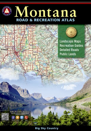
Montana Road & Recreation Atlas - 5th Edition
Benchmark MapsTake the scenic route through the rugged peaks, majestic rivers and expansive plains of Big Sky Country with the 5th edition of Benchmark Maps Montana Road & Recreation Atlas.

Morris County Highlands Trails Map 2023 - 3rd Edition
New York New Jersey TrailA must-have for exploring parks and trails, the Morris County Highlands Trails map (formerly called Jersey Highlands Trails: Central North Region) is a 2-map set covering the New Jersey Highlands.
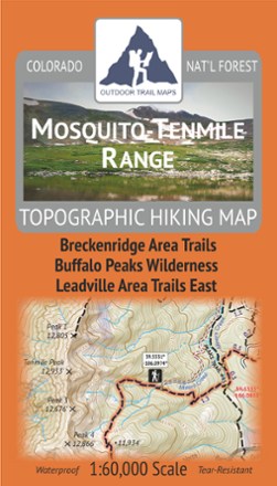
Mosquito-Tenmile Range Topographic Map
Outdoor Trail MapsPlan your own adventure with the tough, compact Mosquito-Tenmile Range topographic map. It shows all the hiking trails in the Mosquito Range and its subrange, the Tenmile Range, of central Colorado.

Mount Baker and Boulder River Wilderness Areas Topographic Map
National GeographicThe Trails Illustrated Mount Baker and Boulder River Wilderness Areas topographic map helps you enjoy the limitless recreational opportunities in the western Cascades of northern Washington.
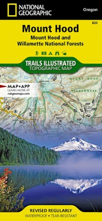
Mount Hood Topographic Map
National GeographicThe Trails Illustrated Mount Hood topographic map was expertly researched in partnership with the U.S. Forest Service and others to offer unparalleled detail for exploring this alpine jewel of Oregon.
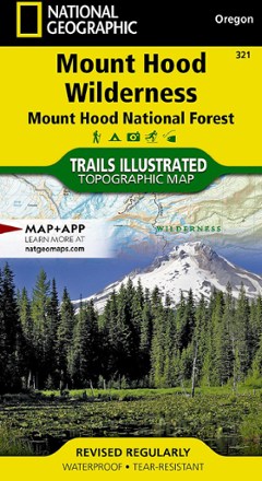
Mount Hood Wilderness Topographic Map
National GeographicThe detailed Trails Illustrated Mount Hood Wilderness topographic map showcases the snowcapped Oregon icon of Mt. Hood—a premier destination for outdoor enthusiasts.
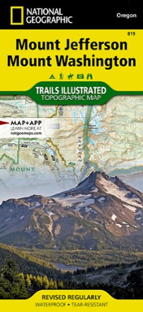
Mount Jefferson and Mount Washington Topographic Map
National GeographicThe Trails Illustrated Mount Jefferson and Mount Washington topographic map combines unmatched detail with helpful info for making the most of your visit to the High Cascades.
North America MapsNew England and Mid Atlantic Maps - DEPRECATED

Mount Jefferson, Bull of the Woods & Opal Creek Wilderness Trail Map
Adventure MapsFeaturing descriptions to 27 hikes, Adventure Maps Mount Jefferson map is your navigational link to the area's incredible volcanic landscapes, old-growth forests and pristine lakes.
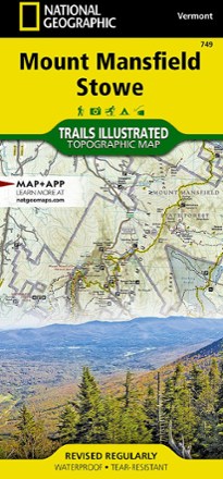
Mount Mansfield / Stowe Topographic Map
National GeographicEnjoy year-round recreational opportunities in northern Vermont with the Trails Illustrated Mount Mansfield / Stowe topographic map.
North America MapsNew England and Mid Atlantic Maps - DEPRECATED
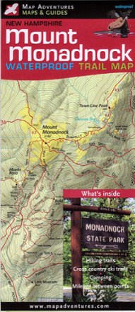
Mount Monadnock Waterproof Trail Map
Map AdventuresFun for families and seasoned hikers alike, Mount Monadnock is open year-round and offers 100-mile views from the summit. Explore all the area offers with the Map Adventures Mount Monadnock map.
North America MapsNew England and Mid Atlantic Maps - DEPRECATED
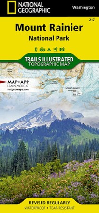
Mount Rainier National Park Trail Map
National GeographicThis colorful Trails Illustrated folded map offers detailed coverage of Mount Rainier National Park in Washington State.
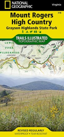
Mount Rogers High Country Map
National GeographicThe National Geographic Trails Illustrated Mount Rogers High Country map offers detailed coverage of the landscapes and sweeping vistas found in Virginia's Grayson Highlands State Park.
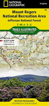
Mount Rogers National Recreation Area Map
National GeographicThis Trails Illustrated folded map offers comprehensive coverage of the Mount Rogers National Recreation Area in Virginia.