Mount Monadnock Waterproof Trail Map
Tech Specs
Specifications are maintained on Pack4Back GearDB (community edits and revision history). Values may differ from the manufacturer or your unit—verify before buying.
BrandMap Adventures
Best UseTravel
Folded DimensionsUnavailable
Unfolded DimensionsUnavailable
Map ScaleUnavailable
Double SidedYes
WaterproofYes
PublisherMap Adventures
Copyright Year2019
State / ProvinceNew Hampshire
Description
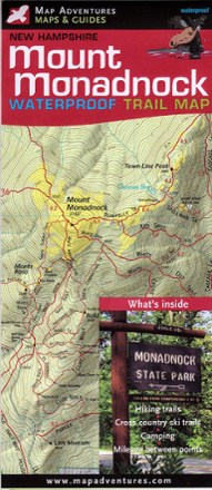
Fun for families and seasoned hikers alike, Mount Monadnock is open year-round and offers 100-mile views from the summit. Explore all the area offers with the Map Adventures Mount Monadnock map.
Features
- Topographical shaded relief map includes accurate and thorough information about hiking and cross-country skiing trails; map covers Mount Monadnock State Park and Gap Mountain
- Features suggested day hikes, campgrounds, remote campsites, mileage between points on hiking trails and an index of trails
- Includes helpful information about the park and useful phone numbers