Filters
No categories available
No brands available
North America Maps
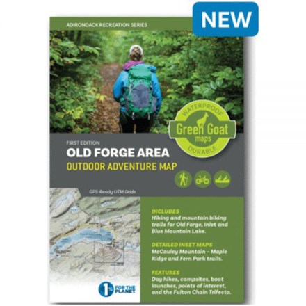
Old Forge Area Outdoor Adventure Map
Green Goat MapsYour guide to outdoor adventures in the Adirondack Park from Old Forge and Blue Mountain Lake, Green Goat Maps The Old Forge Area map shows trail networks, boat access sites and points of interest.
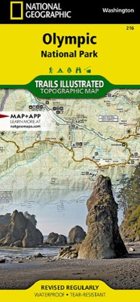
Olympic National Park Topographic Map
National GeographicThe colorful Trails Illustrated Olympic National Park trail map offers detailed coverage of the Olympic Mountains in Washington State.
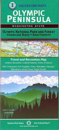
Olympic Peninsula Map
Square One MapsFilled with lush rainforests, rugged coastlines and epic ridges, the Olympic Peninsula takes you off-grid where trails lead to natural springs and camping is at its best. This map shows you the way.

Oregon & Northern California Coast - 9th Edition
The Oregon & Northern California Coast road and recreation map will help you find the road—and beaches and trails—less traveled, from the redwoods to the Columbia River.
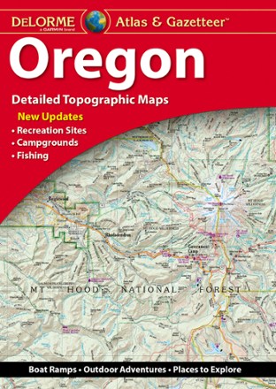
Oregon Atlas and Gazetteer
DeLormeA great companion for recreation and trip planning, the DeLorme Oregon Atlas and Gazetteer covers the entire Beaver State, from the peak of Mount Hood to Crater Lake—the deepest lake in the U.S.
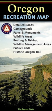
Oregon Recreation Map
Benchmark MapsThe detailed Benchmark Maps Oregon Recreation Map is designed specifically for outdoor adventure. its award-winning design features generous page-to-page overlaps, GPS grids and easy-to-read symbols.
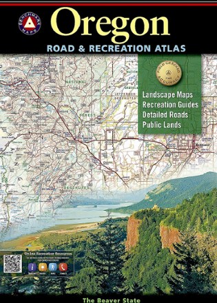
Oregon Road & Recreation Atlas - 9th Edition
Benchmark MapsHop into the navigator's seat and hit the the road with Benchmark Maps Oregon Road and Recreation Atlas, where you'll find vivid, shade-relief maps and all sorts of recreational activities to enjoy.
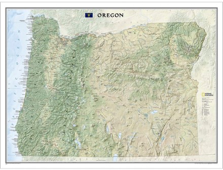
Oregon Wall Map - Tubed
National GeographicIdeal for your home or office, the tubed National Geographic Oregon wall map colorfully displays the Beaver State's diverse terrain and vegetation with shaded relief and ocean bathymetry.
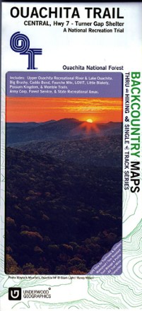
Ouachita Trail Central Map: Highway 7-Turner Gap Shelter
See the best of the Ozarks! One of 3 maps covering this trail, the Ouachita Trail Western topographic hiking map covers the western section of the trail from Talimena State Park to Turner Gap shelter.
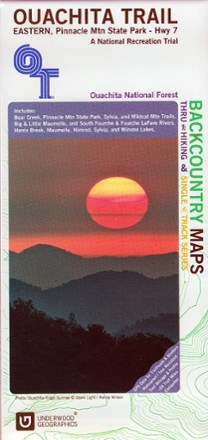
Ouachita Trail Eastern Map: Pinnacle Mountain State Park-Highway 7
See the best of the Ozarks! One of 3 maps covering this trail, the Ouachita Trail Eastern topographic hiking map covers the eastern section of the trail from Pinnacle Mountain State Park to Highway 7.

Ouachita Trail Western Map: Talimena State Park-Turner Gap Shelter
See the best of the Ozarks! One of 3 maps covering this trail, the Ouachita Trail Western topographic hiking map covers the western section of the trail from Talimena State Park to Turner Gap shelter.
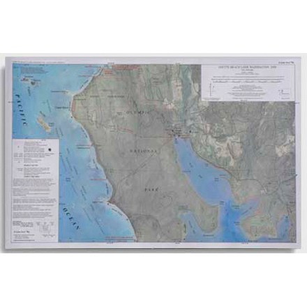
Ozette Beach Loop Map - 4th Edition
This map features trail length and camping areas for the Ozette Beach Loop in Washington.
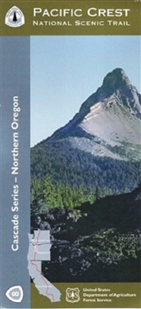
Pacific Crest National Scenic Trail - Northern Oregon (PCT-8) Map
The official Forest Service Pacific Crest National Scenic Trail - Northern Oregon (PCT-8) map shows you the way to ascend more than 57 major mountain passes.
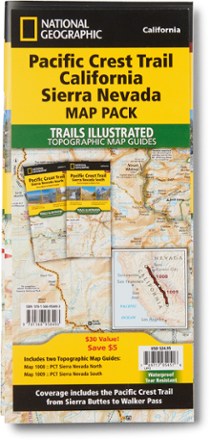
Pacific Crest Trail Topographic Map Guide: California Sierra Nevada Map Pack
National GeographicThe Trails Illustrated Pacific Crest Trail topographic map guide includes 2 map guides that cover the PCT as it navigates the rugged Sierra Nevada in California.