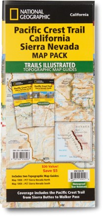

Pacific Crest Trail Topographic Map Guide: California Sierra Nevada Map Pack
Tech Specs
Specifications are maintained on Pack4Back GearDB (community edits and revision history). Values may differ from the manufacturer or your unit—verify before buying.
BrandNational Geographic
Best UseBackpacking
State / ProvinceCalifornia
Folded Dimensions9.25 x 4.25 inches
Unfolded DimensionsUnavailable
Map Scale1:75000
Double SidedYes
WaterproofYes
PublisherNational Geographic
Copyright Year2020
Map Number1008-1009
Description
The Trails Illustrated Pacific Crest Trail topographic map guide includes 2 map guides that cover the PCT as it navigates the rugged Sierra Nevada in California.
Features
- Includes map 1008: Pacific Crest Trail: Sierra Nevada North and map 1009: Pacific Crest Trail: Sierra Nevada South
- Pacific Crest Trail: Sierra Nevada North covers Sierra Buttes to Devils Postpile; Pacific Crest Trail: Sierra Nevada South cover's Devils Postpile to Walker Pass
- Each PCT topographic map guide includes detailed topographic maps at a scale of almost 1 inch : 1 mile
- Made for all levels of hiking enthusiasts, from the day-tripper to the thru-hiker
- The front pages of the printed topographic map guide include resupply locations, health and safety information, and much more
- Each page is centered on the PCT and overlaps with the adjacent pages
- Along the bottom of each page is a trail profile that shows the distance between camping areas, trailheads and other points of interest
- Map and trail profile provide a step-by-step visual guide to hiking the trail, mile by rugged mile
- More convenient and easier to use than folded maps, but just as compact and lightweight, map guide booklets are printed on "Backcountry Tough" waterproof, tear-resistant paper
- A full UTM grid is printed on the map to aid with GPS navigation