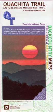
Ouachita Trail Eastern Map: Pinnacle Mountain State Park-Highway 7
Tech Specs
Specifications are maintained on Pack4Back GearDB (community edits and revision history). Values may differ from the manufacturer or your unit—verify before buying.
Description
See the best of the Ozarks! One of 3 maps covering this trail, the Ouachita Trail Eastern topographic hiking map covers the eastern section of the trail from Pinnacle Mountain State Park to Highway 7.
Features
- The Ouachita National Recreation Trail is 223 miles stretching from Talimena State Park in Oklahoma to Pinnacle Mountain State Park on the outskirts of Little Rock, Arkansas
- This map covers Bear Creek, Pinnacle Mountain State Park, Sylvia and Wildcat Mountain trails
- The elevation oscillates between 700 ft. and nearly 2,000 ft.; other small trails are also well marked and documented in this wonderful map
- Printed in color on both sides on waterproof and tear-resistant material for durability