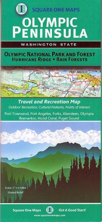
Olympic Peninsula Map
Tech Specs
Specifications are maintained on Pack4Back GearDB (community edits and revision history). Values may differ from the manufacturer or your unit—verify before buying.
BrandSquare One Maps
Best UseTravel
Folded Dimensions8.8 x 4.1 x 0.3 inches
Unfolded Dimensions34.5 x 24.5 inches
Map Scale1 inch: 6 miles
Double SidedYes
PublisherSquare One Maps
Copyright Year2014
State / ProvinceWashington
Description
Filled with lush rainforests, rugged coastlines and epic ridges, the Olympic Peninsula takes you off-grid where trails lead to natural springs and camping is at its best. This map shows you the way.
Features
- Covers Olympic National Park and Forest, Hurricane Ridge, Aberdeen, Port Townsend, Port Angeles, Forks, Hood Canal, Puget Sound, Bremerton and Olympia
- Shows outdoor recreation opportunities, cultural features and points of interest