Filters
No categories available
No brands available
New England And Mid Atlantic Maps
Map D - Trails in the Potomac Gorge Area and the Cabin John Trail
PATCThis map covers trails in the Potomac Gorge Area of Maryland and Northern Virginia and the Cabin John Trail in Maryland.

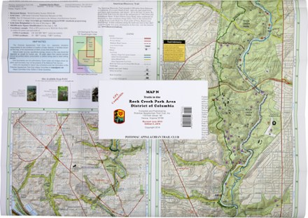
Map N - Trails in the Rock Creek Park Area, District of Columbia
PATCDurable, GPS-compatible and printed in full-color, PATC Map N - Trails in the Rock Creek Park Area is your guide to this outdoor refuge within the District of Columbia.
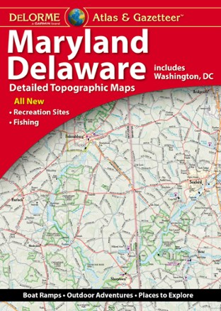
Maryland/Delaware Atlas and Gazetteer
DeLormePerfect for sightseeing, exploring back roads and trip planning, the 2022 edition of the DeLorme Maryland/Delaware Atlas and Gazetteer will help you find and explore hidden corners of these 2 states.

Massachusetts Atlas and Gazetteer
DeLormeTake in the Bay State and venture beyond Boston with the DeLorme Massachusetts Atlas and Gazetteer, which covers the entire state in fine detail.
North America MapsNew England and Mid Atlantic Maps - DEPRECATED

Morris County Highlands Trails Map 2023 - 3rd Edition
New York New Jersey TrailA must-have for exploring parks and trails, the Morris County Highlands Trails map (formerly called Jersey Highlands Trails: Central North Region) is a 2-map set covering the New Jersey Highlands.
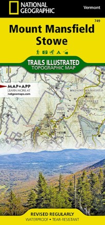
Mount Mansfield / Stowe Topographic Map
National GeographicEnjoy year-round recreational opportunities in northern Vermont with the Trails Illustrated Mount Mansfield / Stowe topographic map.
North America MapsNew England and Mid Atlantic Maps - DEPRECATED
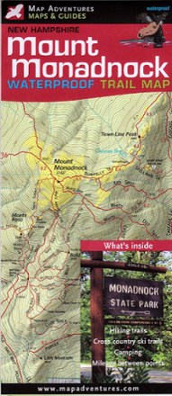
Mount Monadnock Waterproof Trail Map
Map AdventuresFun for families and seasoned hikers alike, Mount Monadnock is open year-round and offers 100-mile views from the summit. Explore all the area offers with the Map Adventures Mount Monadnock map.
North America MapsNew England and Mid Atlantic Maps - DEPRECATED

Mt. Mansfield and the Worcester Range Hiking Trail Map
Green Mountain ClubExplore the many trails of Vermont's highest peak with the Green Mountain Club Mount Mansfield and Worcester Range trail map as your weatherproof guide to this spectacular region of New England.

New Hampshire's Presidential Range Backcountry Ski Map
With over 100 routes for epic trips and making fresh tracks, New Hampshire's Presidential Range Backcountry Ski map is a ski-specific map and guide to the area's best steeps and descents.
North America MapsNew England and Mid Atlantic Maps - DEPRECATED

New Hampshire/Vermont Atlas and Gazetteer
DeLormePlan your next New England road trip with the DeLorme New Hampshire/Vermont Atlas and Gazetteer. The detailed maps are great for taking the scenic route and finding spots for outdoor exploration.

New York Atlas and Gazetteer
DeLormePerfect for sightseeing, road tripping and finding your new favorite hiking spot, the DeLorme New York Atlas and Gazetteer covers the entire state in detail, from the Big Apple to the Adirondacks.
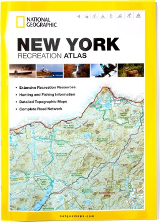
New York Recreation Atlas
National GeographicThe National Geographic New York Recreation Atlas offers detailed topographic maps, complete road networks and extensive recreation resources for the Empire State.
North America MapsNew England and Mid Atlantic Maps - DEPRECATED
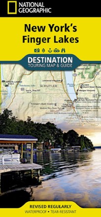
New York's Finger Lakes Destination Touring Map & Guide
National GeographicNew York's Finger Lakes Destination touring map & guide by National Geographic strikes the perfect balance between map and guidebook. It is an ideal resource for touring this unique region.
North America MapsNew England and Mid Atlantic Maps - DEPRECATED
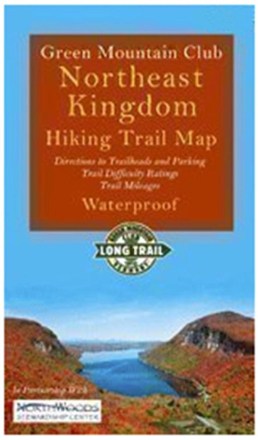
Northeast Kingdom Hiking Trail Map
Green Mountain ClubExplore Vermont's Northeast Kingdom hiking trails. This Green Mountain Club map now includes the Kingdom Heritage Trail on Middle Mountain and Bluff Ridge, plus trail relocation on Wheeler Mountain.