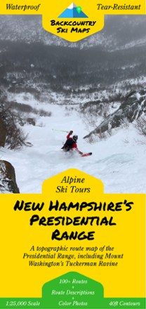
New Hampshire's Presidential Range Backcountry Ski Map
Tech Specs
Specifications are maintained on Pack4Back GearDB (community edits and revision history). Values may differ from the manufacturer or your unit—verify before buying.
Description
With over 100 routes for epic trips and making fresh tracks, New Hampshire's Presidential Range Backcountry Ski map is a ski-specific map and guide to the area's best steeps and descents.
Features
- This highly detailed topographic map with 40 ft. contour lines is printed on waterproof, tear-resistant tree-free synthetic paper for durability and use in any conditions
- Including Mount Washington's Tuckerman Ravine, this map features route guides to over 100 of the area's best descents with detailed text and color photos
- Also includes suggested ascent routes to help get you up the hill as efficiently as possible
- The variety of descents appeals to backcountry skiers of all skill levels