Filters
No categories available
No brands available
Midwest Maps
Ohio Atlas and Gazetteer - 2022 Edition
DeLormeA great companion for outdoor recreation and trip planning, the DeLorme Ohio Atlas and Gazetteer covers every inch of the Buckeye State in fine detail.
Southern Appalachian Road and Recreation Atlas
Benchmark MapsExplore highways and byways of America's historic mountain frontier with the Benchmark Maps Southern Appalachian Road and Recreation Atlas in the lap of the navigator.
Voyageurs National Park Topographic Map
National GeographicThe Trails Illustrated Voyageurs National Park topographic map combines unmatched detail with helpful information, offering a valuable tool for making the most of your visit to this inspiring region.

Walden / Gould Topographic Map
National GeographicThe Trails Illustrated Walden / Gould topographic map combines unmatched detail with helpful info to offer a valuable tool for making the most of your travels in North Park and the surrounding areas.
Wisconsin Atlas and Gazetteer
DeLormeFrom the shores of Lake Superior and Lake Michigan to the forests and bluffs of the Western Upland, the DeLorme Wisconsin Atlas and Gazetteer covers the entire Badger State in fine detail.
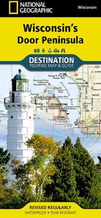
Wisconsin's Door Peninsula Destination Map
National GeographicTrails Illustrated Wisconsin's Door Peninsula Destination Map strikes a balance between travel map and guidebook—a great resource for touring this culturally and geographically unique region.