Filters
No categories available
No brands available
Media

Colorado Uncompahgre Wilderness Map
Outdoor Trail MapsThe Colorado Uncompahgre Wilderness topographic hiking map shows all of the hiking trails in this wilderness area spanning 103,000 acres in southwest Colorado's San Juan Mountains.

Colorado Vasquez/Byers/Ptarmigan Peak Wilderness Map
Outdoor Trail MapsThis Colorado Vasquez/Byers/Ptarmigan Peak Wilderness topographic hiking map shows all of the hiking trails in 3 wilderness areas spanning the Continental Divide over the central Front Range.
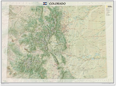
Colorado Wall Map - Tubed
National GeographicThe tubed National Geographic Colorado wall map offers a colorful visualization of the Centennial State's physical geography, forests and deserts, while stunning shaded relief depicts mountains.
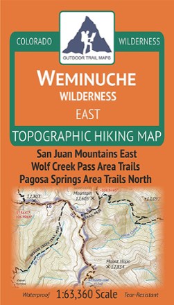
Colorado Weminuche Wilderness East Map
Outdoor Trail MapsThe Colorado Weminuche Wilderness East topographic hiking map shows all of the hiking trails in the eastern part of the Weminuche Wilderness in the San Juan Mountains of southern Colorado.

Colorado Weminuche Wilderness West Map
Outdoor Trail MapsThe Colorado Weminuche Wilderness West topographic hiking map shows all of the hiking trails in the western part of the Weminuche Wilderness in the San Juan Mountains of southern Colorado.

Colorado West Elk Wilderness Map
Outdoor Trail MapsHike to your heart's content in Colorado's rugged West Elk Wilderness with this topographic hiking map, covering the West Elk Mountains, the Castles and Gunnison Area Trails West.
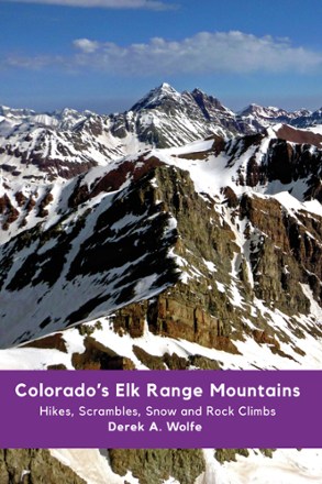
Colorado's Elk Range Mountains: Hikes, Scrambles, Snow and Rock Climbs
Sharp End PublishingEverything you need to explore this idyllic range, the Colorado's Elk Range Mountains guidebook is a tome of high-altitude ascents in the rugged Rockies between Aspen and Crested Butte.
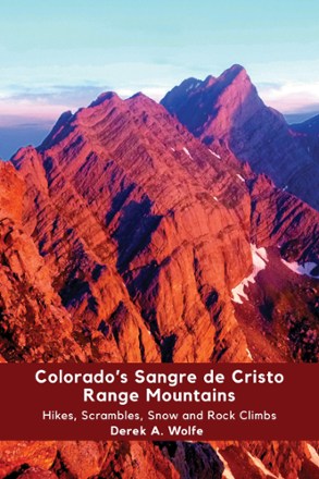
Colorado's Sangre de Cristo Range Mountains: Hikes Scrambles, Snow and Rock Climbs
Sharp End PublishingOpen this guide to Colorado's Sangre de Cristo Range Mountains to begin exploring the adventures you can have among the deep valleys and 14,000 ft. peaks of southern Colorado.
Camping and Hiking GuidebooksNorth America Hiking Guidebooks
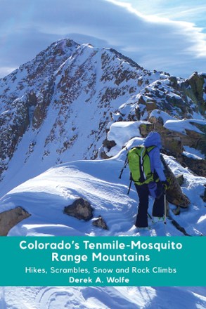
Colorado's Tenmile-Mosquito Range Mountains: Hikes, Scrambles, Snow and Rock Climbs
Sharp End PublishingColorado's Tenmile-Mosquito Range Mountains guide offers something for everyone with a variety of hikes, scrambles, rock climbs and snow climbs throughout the high-elevation range.
Camping and Hiking GuidebooksNorth America Hiking Guidebooks
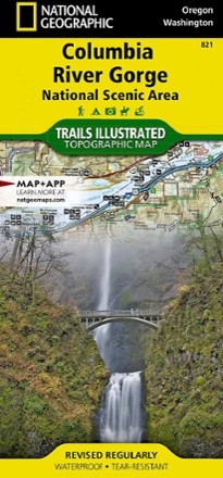
Columbia River Gorge Topographic Map
National GeographicExpertly researched in partnership with local land management agencies, the Trails Illustrated Columbia River Gorge topographic map offers an unparalleled tool for exploring this breathtaking region.
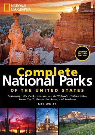
Complete National Parks of the United States - Second Edition
National GeographicA comprehensive guide to America's outdoor treasures, National Geographic Complete National Parks of the United States leads you to the best hiking trails, historic sites, seashores and campgrounds.
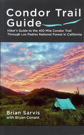
Condor Trail Guide
Hiking the Condor Trail can be a serious thru-hike or a challenging series of section hikes. Luckily, you can be prepared for either with the Condor Trail Guide by Brian Sarvis.
Camping and Hiking GuidebooksNorth America Hiking Guidebooks
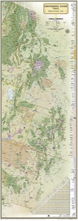
Continental Divide Trail Wall Map
National GeographicExpertly researched and designed, this National Geographic map of the Continental Divide Trail is ideal for fans and hikers of this magnificent National Scenic Trail.
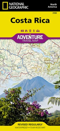
Costa Rica Adventure Map
National GeographicPlan your trip and explore Costa Rica with this National Geographic map, featuring topography, detailed maps and useful guide information.