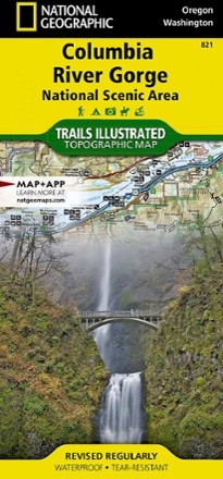


Columbia River Gorge Topographic Map
Tech Specs
Specifications are maintained on Pack4Back GearDB (community edits and revision history). Values may differ from the manufacturer or your unit—verify before buying.
Description
Expertly researched in partnership with local land management agencies, the Trails Illustrated Columbia River Gorge topographic map offers an unparalleled tool for exploring this breathtaking region.
Features
- Includes the White Salmon, Klickitat, Sandy and lower Deschutes rivers, Yacolt Burn State Forest and Maryhill, Columbia Hills and Rooster Rock state parks
- Also includes Mark O. Hatfield Wilderness and portions of Mount Hood and Gifford-Pinchot national forests
- Easy-to-read, yet highly detailed map shows comprehensive trail and road networks, along with designated trails for hiking, horseback riding, biking and more
- Clearly marked navigational aids with UTM coordinate grids, scale bar and full legend, essential for safely navigating the backcountry with GPS or compass
- Features key points of interest such as scenic views, campgrounds, trailheads, boat launches and picnic sites
- Color-coded boundaries for public lands including national parks, national forests, national monuments, ranger districts, wilderness areas, state parks and wildlife refuges
- 1:75,000 scale
- Printed in the USA on durable, lightweight, waterproof and tear-resistant material designed to withstand all weather conditions
- Folded dimensions: 4.25 x 9.25 in.; unfolded dimensions: 37.75 x 25.5 in.
- National Geographic Maps; copyright 2009