Media
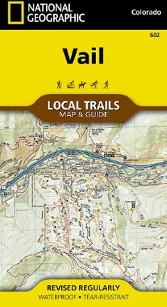
Vail Local Trails Map & Guide
National GeographicTake a hike with this National Geographic Local Trails map and guide of Vail, Colorado—situated at 8,150 ft. in the upper reaches of the Gore Valley and encircled by the White River National Forest.

Vail, Frisco, and Dillon Topographic Map
National GeographicThe Trails Illustrated Vail, Frisco, and Dillon topographic map is an unparalleled tool for exploring this region of the Colorado Rockies.

Valley of Fire State Park Adventure Guide
Franko's MapsValley of Fire State Park is a geologic wonderland with trails, campsites and ancient, petrified trees and petroglyphs. Use Franko's Maps Valley of Fire State Park Adventure Guide to discover it all.

Vancouver & Victoria - 8th Edition
Lonely Planet GuidesShop for vintage shoes in Gastown, hit the slopes of Grouse Mountain and sample an IPA in a hidden brewery—all with Lonely Planet's Vancouver & Victoria as your guide for what to see and what to skip.
North America Travel GuidebooksCanada Travel Guidebooks - DEPRECATED

Vancouver Island, Canada, Map
National GeographicThis National Geographic Vancouver Island Adventure Map provides global travelers with the perfect combination of detail and perspective in a highly functional travel tool.

Vancouver Rock Climbing
Quickdraw PublicationsWith 300 routes, 600 boulder problems and a handful of fine alpine objectives, Vancouver Rock Climbing provides comprehensive coverage of the diverse climbing scene around Vancouver, Canada.
North America Climbing GuidebooksCanada Climbing Guidebooks - DEPRECATED
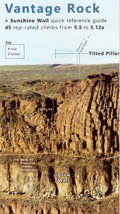
Vantage Rock: A Sunshine Wall Quick-Reference Guide
Composed from several telephoto images taken from across Echo Basin on November 2016, Vantage Rock: A Sunshine Wall Quick-Reference Guide offers a panoramic view of the wall and its climbing routes.

Verdugo Mountains Trail Map
Tom Harrison CartographyThis high-quality, shaded topographic map elaborately details the Verdugo Mountains' motorways and trails.

Views From On High - 2nd Edition
Adirondack Mountain ClubA popular guide to fire tower trails, this 2nd edition of the Adirondack Mountain Club Views From On High enables hikers and history buffs to visit and learn about 30 historic fire towers.
Camping and Hiking GuidebooksNorth America Hiking Guidebooks

Virginia Atlas and Gazetteer
DeLormeFrom Chesapeake Bay to the picturesque Blue Ridge Mountains, the DeLorme Virginia Atlas and Gazetteer covers all of Old Dominion in fine detail.
North America MapsNew England and Mid Atlantic Maps - DEPRECATED

Voyageurs National Park Topographic Map
National GeographicThe Trails Illustrated Voyageurs National Park topographic map combines unmatched detail with helpful information, offering a valuable tool for making the most of your visit to this inspiring region.

Walden / Gould Topographic Map
National GeographicThe Trails Illustrated Walden / Gould topographic map combines unmatched detail with helpful info to offer a valuable tool for making the most of your travels in North Park and the surrounding areas.

Walkable Westchester - 3rd Edition
New York New Jersey TrailThe 3rd edition of Walkable Westchester—with updated maps, tables and locations—is a comprehensive go-to guide to over 225 parks and 635 miles of trails for you to explore in Westchester County.
Camping and Hiking GuidebooksNorth America Hiking Guidebooks

Walking Chicago
Wilderness PressGrab your walking shoes and experience the Windy City with Walking Chicago—filled with 35 urban treks through one of the most walkable and culturally diverse cities in the country.
North America Hiking GuidebooksMidwest Hiking Guidebooks - DEPRECATED