Angeles Front Country Trail Map
Tom Harrison CartographyAn invaluable resource for the Los Angeles area hiker, the Tom Harrison Cartography Angeles Front Country Trail Map details an area accessible via the Angeles Crest highway, just north of the city.
Big Rock Ridge-Indian Valley Trail Map
Tom Harrison CartographyDiscover fantastic hiking, running, equestrian and MTB trails in the rolling hills and valleys of California's Marin County with the Tom Harrison Cartography Big Rock Ridge–Indian Valley trail map.
Bodie Hills Trail Map
Tom Harrison CartographyFeaturing the old ghost town of Bodie and its surrounding areas, the Tom Harrison Cartography Bodie Hills Trail Map is your guide to this popular region of the eastern Sierra.
Cheeseboro - Palo Comado Canyons Trail Map
Tom Harrison CartographyThe Cheeseboro - Palo Comado Canyons trail map offers a full-color, topographic guide with shaded relief for hiking, backpacking, and mountain biking around this Ventura County open space.
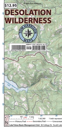
Desolation Wilderness Map
Tom Harrison CartographyGet your guide to one of the most popular backpacking ares in the Sierra Nevada. With the Tom Harrison Cartography Desolation Wilderness map, you can plan your next hike or backpacking trip with ease.
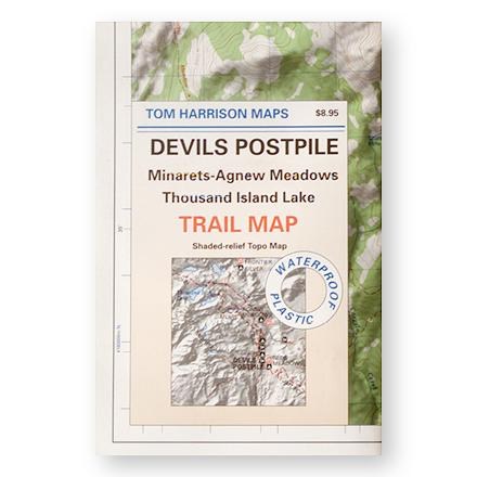
Devil's Postpile, Minarets-Agnew Meadows, Thousand Island Lake Trail Map
Tom Harrison CartographyShaded-relief topo map of the Devil's Postpile, Minarets-Agnew Meadows, Thousand Island Lake area printed on waterproof plastic
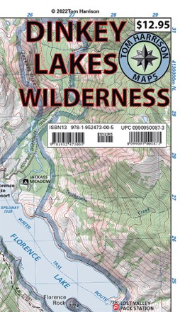
Dinkey Lakes Wilderness Map
Tom Harrison CartographyDon't leave on your next Sierra Nevada adventure without the Dinkey Lakes Wilderness map from Tom Harrison Cartography. The full color map highlights all the info you need to plan your next trip.

Emigrant Wilderness Map
Tom Harrison CartographyDiscover the hiking trails of California's Emigrant Wilderness—located just north of Yosemite National Park—with this map from Tom Harrison Cartography.

Half Dome, Glacier Point, Yosemite Creek, Tenaya Lake, Little Yosemite Valley Topo Map
Tom Harrison CartographyShaded-relief topo map of the Half Dome, Glacier Point, Yosemite Creek, Tenaya Lake, Little Yosemite Valley area--printed on waterproof plastic.
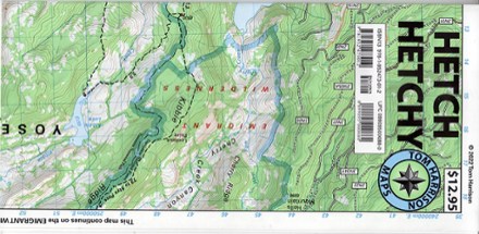
Hetch Hechy Map
Tom Harrison CartographyTake a deep dive into a popular area of Yosemite National Park with the Tom Harrison Cartography Hetch Hechy map. The full color map highlights the hiking trails around Hetch Hetchy Reservoir.
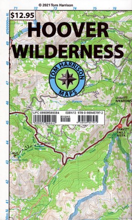
Hoover Wilderness Map
Tom Harrison CartographyReady to explore the Sierra Nevada? You'll want this Tom Harrison Cartography trail map to guide you to some of the best hiking trails in the Hoover Wilderness northeast of Yosemite.
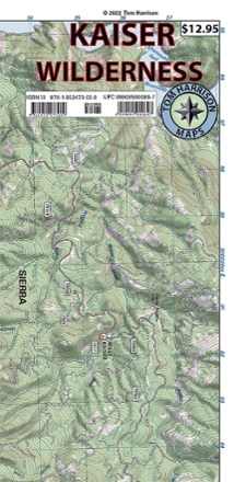
Kaiser Wilderness Map
Tom Harrison CartographyGet off the beaten path with the Tom Harrison Cartography Kaiser Wilderness map. Explore the trails and other recreation opportunities around Huntington Lake with this full color map.
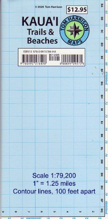
Kaua'i Trails and Beaches Map
Tom Harrison CartographyA paradise of adventure awaits! The Tom Harrison Cartography Kaua'i Trails and Beaches map takes you to scenic beaches and trails of the Hawaiian island of Kaua'i.
Malibu Creek State Park Trail Map
Tom Harrison CartographyShaded-relief topo map of Malibu Creek, Castro Crest, Corral Canyon, Backbone Trail, Solstice Canyon and Paramount Ranch.