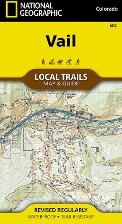


Vail Local Trails Map & Guide
Tech Specs
Specifications are maintained on Pack4Back GearDB (community edits and revision history). Values may differ from the manufacturer or your unit—verify before buying.
BrandNational Geographic
Best UseHiking
State / ProvinceColorado
Folded Dimensions7.5 x 4 inches
Unfolded Dimensions26.5 x 19.5 inches
Map Scale1:31,680
Double SidedYes
WaterproofYes
PublisherNational Geographic
Copyright Year2018
Map Number602
Description
Take a hike with this National Geographic Local Trails map and guide of Vail, Colorado—situated at 8,150 ft. in the upper reaches of the Gore Valley and encircled by the White River National Forest.
Features
- Vail has a world-class alpine ski resort and a friendly community with a small-town feel
- Visitors can find varied shops and restaurants, luxurious accommodations, bountiful cultural events and year-round recreational opportunities—from hiking to skiing to biking
- This map is a combination of a standard trail map on the front with a helpful guide on the back that has a selection of hikes
- Recommended hikes range from the moderate 2.9-mile Berrypicker to the strenuous 3,100-foot climb up to Pitkin Lake
- Each selected trail includes a brief description, elevation gain and length, and a detailed elevation profile to track your progress up and down the numerous peaks and valleys
- Each Local Trails map includes detailed trail maps at 1 in. = 1/2 mile
- In addition to the standard features like trailheads and parking areas, map also shows trail difficulties by segment, so you can assess the level for parts of the trail or all