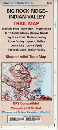
Big Rock Ridge-Indian Valley Trail Map
Tech Specs
Specifications are maintained on Pack4Back GearDB (community edits and revision history). Values may differ from the manufacturer or your unit—verify before buying.
Best UseHiking
Folded Dimensions9 x 4 x 0.2 inches
Unfolded Dimensions24 x 18 inches
Map Scale1:24,000
Double SidedYes
WaterproofYes
PublisherTom Harrison Cartography
Copyright Year2007
State / ProvinceCalifornia
Description
Discover fantastic hiking, running, equestrian and MTB trails in the rolling hills and valleys of California's Marin County with the Tom Harrison Cartography Big Rock Ridge–Indian Valley trail map.
Features
- Covers the areas of McInnis Park, Hamilton, Marinwood, Terra Linda–Sleepy Hollow Divide, Big Rock Trail, Loma Alta, Loma Verde and Pacheco Valle
- Also covers the Gallinas, Ignacio, Lucas and Indian valleys
- Full-color shaded-relief topographic map on high-quality tear- and water-resistant paper; folds up easily and is easy to read in all conditions
- Tom Harrison maps include color-coded symbols and trails, mileage between trail junctions, UTM grids, contour lines, vegetation and elevations at trail junctions