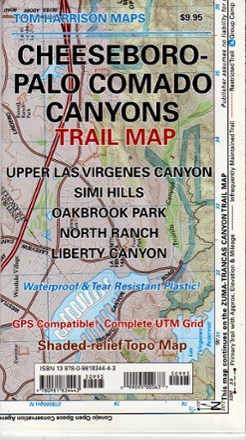
Cheeseboro - Palo Comado Canyons Trail Map
Tech Specs
Specifications are maintained on Pack4Back GearDB (community edits and revision history). Values may differ from the manufacturer or your unit—verify before buying.
Description
The Cheeseboro - Palo Comado Canyons trail map offers a full-color, topographic guide with shaded relief for hiking, backpacking, and mountain biking around this Ventura County open space.
Features
- Map features color-coded symbols and trails, mileages between trail junctions, latitude/longitude, UTM grids, contour lines, vegetation and elevations at trail junctions
- Measures 24 x 18 in. (8 x 4.5 in. folded); scale of 1:31,680
- The Cheeseboro - Palo Comado Canyons trail map is printed on waterproof, tear-resistant material
- Tom Harrison Maps; copyright 2012