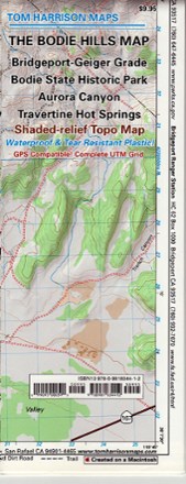
Bodie Hills Trail Map
Tech Specs
Specifications are maintained on Pack4Back GearDB (community edits and revision history). Values may differ from the manufacturer or your unit—verify before buying.
Best UseHiking
Folded Dimensions9 x 4 x 0.1 inches
Unfolded Dimensions21.5 x 18.5 inches
Map Scale1:63,360
Double SidedYes
WaterproofYes
PublisherTom Harrison Cartography
Copyright Year2009
State / ProvinceCalifornia
Description
Featuring the old ghost town of Bodie and its surrounding areas, the Tom Harrison Cartography Bodie Hills Trail Map is your guide to this popular region of the eastern Sierra.
Features
- Includes the Bridgeport-Geiger Grade, Bodie State Historic Park, Aurora Canyon and Travertine Hot Springs
- Full-color shaded-relief topographic map on high-quality tear- and water-resistant paper; folds up easily and is easy to read in all conditions
- Tom Harrison maps include color-coded symbols and trails, mileage between trail junctions, UTM grids, contour lines, vegetation and elevations at trail junctions