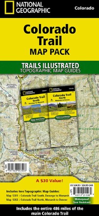

Colorado Trail Topographic Map Pack - Set of 2 Map Guides
Tech Specs
Specifications are maintained on Pack4Back GearDB (community edits and revision history). Values may differ from the manufacturer or your unit—verify before buying.
BrandNational Geographic
Best UseHiking
State / ProvinceColorado
Folded Dimensions9.25 x 4.25 inches
Unfolded DimensionsBooklets
Map Scale1:75,000
Double SidedYes
WaterproofYes
PublisherNational Geographic
Copyright Year2018
Map Number1196
Description
If you're planning a thru-hike to see the stunning scenery along Colorado's premier long distance trail, this set of 2 National Geographic Colorado Trail topo map guides has all the details you need.
Features
- Conceived in 1973 and completed in 1987, the trail runs 486 miles between Denver and Durango, traversing some of the most spectacular scenery in the state
- Map pack combines the entire standard route into a single easy-to-purchase product
- Pack includes: Map 1201 - Colorado Trail South and Map 1202 - Colorado Trail North
- Expertly researched and created by National Geographic Maps in partnership with The Colorado Trail Foundation
- More convenient and easier to use than folded maps, the map guide booklets provide a wealth of info while still being compact and lightweight
- Provides detailed topographic maps, interesting history and bike detour maps
- Resupply location chart shows distances to and services available at resupply points
- Each page is centered on the trail and overlaps with adjacent pages to make navigation simple
- Along the bottom of each page is a trail profile that shows the distance between passes, camping areas and trail access points
- Map and trail profile provide a step-by-step visual guide to hiking the trail
- Full UTM grid is printed on the map to aid with GPS navigation
- Printed on Backcountry Tough waterproof, tear-resistant paper with stainless steel staples