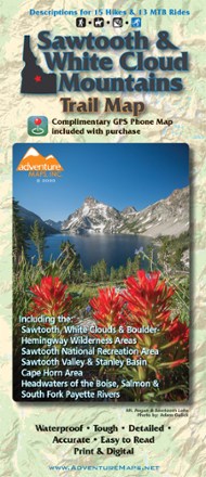
Sawtooth and White Cloud Mountains Trail Map
Tech Specs
Specifications are maintained on Pack4Back GearDB (community edits and revision history). Values may differ from the manufacturer or your unit—verify before buying.
BrandAdventure Maps
Best UseMountain Biking
Folded Dimensions9.75 x 4 x 0.25 inches
Unfolded Dimensions27 x 39 inches
Map Scale1:63,360
Double SidedYes
WaterproofYes
PublisherAdventure Maps, Inc.
Copyright Year2020
State / ProvinceIdaho
Description
For awe-inspiring views of pristine lakes, peaks and landscapes, Adventure Maps Sawtooth and White Cloud Mountains map is your navigational link to take it all in by foot, mountain bike or horseback.
Features
- Covers the Sawtooth, White Clouds and Boulder-Hemingway Wilderness Areas, as well as the Sawtooth National Recreation Area
- Also covers Sawtooth Valley and Stanley Basin, Cape Horn Area, and the headwaters of the Boise, Salmon and South Fork Payette Rivers
- Waterproof, tearproof color topographic map with UTM grid includes detailed legend, area info and descriptions to 15 hikes and 13 mountain bike rides of varying difficulty
- Includes a link to a downloadable PDF map that can be downloaded before your trip and used on your phone without cell service