Filters
No categories available
No brands available
Maps
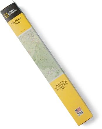
Colorado Trail Wall Map
National GeographicShowing the entire length of the trail from Durango to Denver as it travels on the ridge of the Rocky Mountains, the Trails Illustrated Colorado Trail wall map is both a planning tool and wall decor.

Colorado Uncompahgre Wilderness Map
Outdoor Trail MapsThe Colorado Uncompahgre Wilderness topographic hiking map shows all of the hiking trails in this wilderness area spanning 103,000 acres in southwest Colorado's San Juan Mountains.

Colorado Vasquez/Byers/Ptarmigan Peak Wilderness Map
Outdoor Trail MapsThis Colorado Vasquez/Byers/Ptarmigan Peak Wilderness topographic hiking map shows all of the hiking trails in 3 wilderness areas spanning the Continental Divide over the central Front Range.
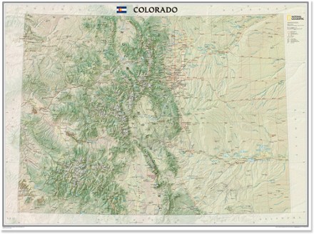
Colorado Wall Map - Tubed
National GeographicThe tubed National Geographic Colorado wall map offers a colorful visualization of the Centennial State's physical geography, forests and deserts, while stunning shaded relief depicts mountains.
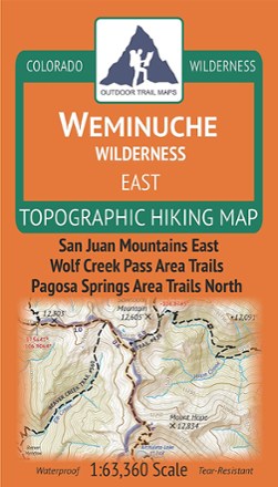
Colorado Weminuche Wilderness East Map
Outdoor Trail MapsThe Colorado Weminuche Wilderness East topographic hiking map shows all of the hiking trails in the eastern part of the Weminuche Wilderness in the San Juan Mountains of southern Colorado.

Colorado Weminuche Wilderness West Map
Outdoor Trail MapsThe Colorado Weminuche Wilderness West topographic hiking map shows all of the hiking trails in the western part of the Weminuche Wilderness in the San Juan Mountains of southern Colorado.

Colorado West Elk Wilderness Map
Outdoor Trail MapsHike to your heart's content in Colorado's rugged West Elk Wilderness with this topographic hiking map, covering the West Elk Mountains, the Castles and Gunnison Area Trails West.
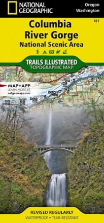
Columbia River Gorge Topographic Map
National GeographicExpertly researched in partnership with local land management agencies, the Trails Illustrated Columbia River Gorge topographic map offers an unparalleled tool for exploring this breathtaking region.
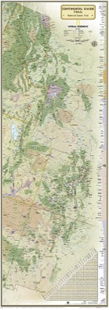
Continental Divide Trail Wall Map
National GeographicExpertly researched and designed, this National Geographic map of the Continental Divide Trail is ideal for fans and hikers of this magnificent National Scenic Trail.
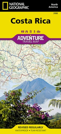
Costa Rica Adventure Map
National GeographicPlan your trip and explore Costa Rica with this National Geographic map, featuring topography, detailed maps and useful guide information.
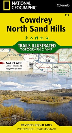
Cowdrey/North Sand Hills Trail Map
National GeographicThis colorful Trails Illustrated folded map offers comprehensive coverage of Cowdrey and the North Sand Hills area in Colorado.
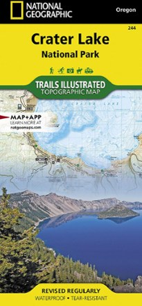
Crater Lake National Park Map
National GeographicThis Trails Illustrated folded map offers comprehensive coverage of Crater Lake National Park in Oregon.

Crazy Mountains Recreation Map
Beartooth PublishingLocated in southern Montana, the Crazy Mountains have a dedicated following of outdoor enthusiasts. Count yourself as one with this map from Beartooth Publishing.

Crested Butte Pearl Pass Map
National GeographicThis Trails Illustrated folded map offers comprehensive coverage of the Crested Butte and Pear Pass recreation areas in Colorado.