Filters
No categories available
No brands available
Colorado Maps Deprecated

Colorado La Garita Wilderness Map
Outdoor Trail MapsExplore Colorado's San Juans with this La Garita Wilderness topographic hiking map, covering all of the hiking trails in the 130,000-acre La Garita Wilderness area in southern Colorado.
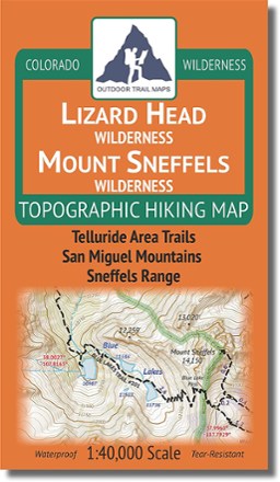
Colorado Lizard Head/Mount Sneffels Wilderness Map
Outdoor Trail MapsEnjoy the majesty of southwest Colorado's San Juan Mountains in the Lizard Head Wilderness and Mount Sneffels Wilderness areas. Design your own adventure with this detailed topographic map.
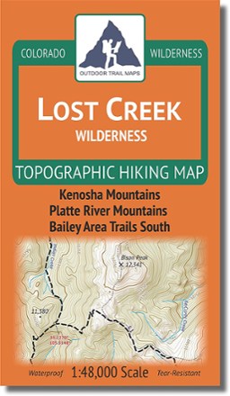
Colorado Lost Creek Wilderness Map
Outdoor Trail MapsPlot your own adventure with this Colorado Lost Creek Wilderness topographic hiking map, covering all the hiking trails in the 115,000-acre Lost Creek Wilderness just 40 miles southwest of Denver.
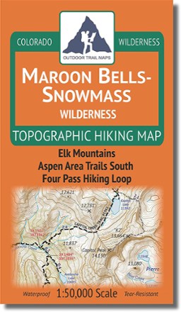
Colorado Maroon Bells-Snowmass Wilderness Map
Outdoor Trail MapsColorado's Maroon Bells–Snowmass Wilderness spans 182,000 acres across the Elk Mountains south of Aspen and north of Crested Butte. Use this topographic map to explore it to your heart's content.

Colorado Mount Evans Wilderness Map
Outdoor Trail MapsSpanning 73,000 acres of wilderness south of Georgetown, Colorado, this highly detailed hiking map of Mount Evans Wilderness takes you on a journey among craggy peaks, pristine lakes and dense woods.
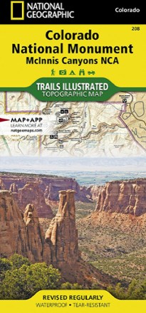
Colorado National Monument Topographic Map
National GeographicThe Trails Illustrated Colorado National Monument topographic map details the recreation areas throughout Colorado's Grand Valley that surrounds the towns of Grand Junction, Fruita, Palisade and Loma.
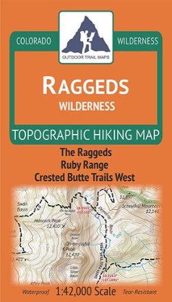
Colorado Raggeds Wilderness Map
Outdoor Trail MapsExplore Colorado's Western Slope with this Raggeds Wilderness topographic hiking map, covering all of the hiking trails in the 65,000-acre Raggeds Wilderness west of Crested Butte.

Colorado Rawah Wilderness Map
Outdoor Trail MapsCovering 75,000 acres of wilderness south of Wyoming border, this highly detailed hiking map of Rawah Wilderness leads you along the trail to epic views of lakes, mountains and wide, open spaces.

Colorado Road & Recreation Atlas - 7th Edition
Benchmark MapsHop into the navigator's seat with the Benchmark Maps Colorado Road and Recreation Atlas and see the state's beauty on the road with vivid, shade-relief maps and recreational details to stop off for.

Colorado Rocky Mountain National Park Map
Outdoor Trail MapsWith so much to explore throughout Rocky Mountain National Park, you're bound to discover plenty of incredible lakes, jagged peaks and densely wooded areas with this highly detailed hiking map.

Colorado Sangre de Cristo Wilderness North Map
Outdoor Trail MapsThis Colorado Sangre de Cristo Wilderness North topographic hiking map shows all of the hiking trails in the northern part of the Sangre de Cristo Wilderness of central Colorado.

Colorado Sangre de Cristo Wilderness South Map
Outdoor Trail MapsThis Colorado Sangre de Cristo Wilderness South topographic hiking map shows all of the hiking trails in the southern part of the Sangre de Cristo Wilderness of central Colorado.
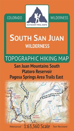
Colorado South San Juan Wilderness Map
Outdoor Trail MapsPlot your own adventure with this Colorado South San Juan Wilderness topographic hiking map, covering all the hiking trails in this wilderness area in the southern portion of the San Juan Mountains.

Colorado Springs Pikes Peak Map
Sky Terrain Trail MapsThis detailed map of Springs Pikes Peak is easy to use and waterproof; providing trial ratings, 3D views, shaded relief and is GPS ready