

Colorado National Monument Topographic Map
Tech Specs
Specifications are maintained on Pack4Back GearDB (community edits and revision history). Values may differ from the manufacturer or your unit—verify before buying.
Description
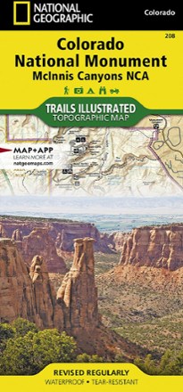
The Trails Illustrated Colorado National Monument topographic map details the recreation areas throughout Colorado's Grand Valley that surrounds the towns of Grand Junction, Fruita, Palisade and Loma.
Features
- Expertly researched map was created in partnership with local land management agencies
- Covers McInnis Canyon, James M. Robb-Colorado River and Highline Lake state parks, Little Book Cliffs Wild Horse Range, Westwater Canyon and Black Ridge Canyons Wilderness
- Inset of Colorado National Monument provides greater detail of this remarkable area
- Easy-to-read, yet highly detailed map shows comprehensive trail and road networks, along with designated trails for hiking, horseback riding, biking and more
- Clearly marked navigational aids with UTM coordinate grids, scale bar and full legend, essential for safely navigating the backcountry with GPS or compass
- Features key points of interest such as scenic views, campgrounds, trailheads, boat launches and picnic sites
- Color-coded boundaries for public lands including national parks, national forests, national monuments, ranger districts, wilderness areas, state parks and wildlife refuges
- 1:70,000 scale
- Printed in the USA on durable, lightweight, waterproof and tear-resistant material designed to withstand all weather conditions
- Folded dimensions: 4.25 x 9.25 in.; unfolded dimensions: 37.75 x 25.5 in.
- National Geographic Maps; copyright 2008