Filters
No categories available
No brands available
Colorado Maps Deprecated

Buffalo Creek and Waterton Canyon Trail Map - 1st Edition
Sky Terrain Trail MapsVenture just beyond Denver's city limits and into the wilderness with the waterproof, pocket-size Sky Terrain Buffalo Creek and Waterton Canyon Trail Map, filled with an abundance of trails to trek.

Cache La Poudre / Big Thompson Topographic Map
National GeographicOutdoor enthusiasts looking for opportunities just east of Rocky Mountain National Park will find the Trails Illustrated Cache La Poudre / Big Thompson topographic map an essential travel companion.
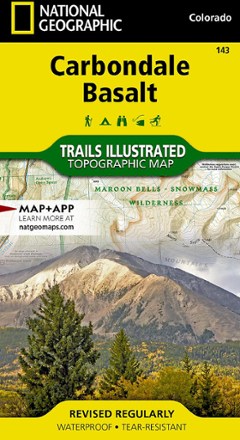
Carbondale/Basalt Trail Map
National GeographicThis National Geographic Trails Illustrated folded map offers comprehensive coverage of Colorado's Carbondale and Basalt.
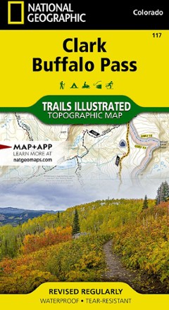
Clark / Buffalo Pass Topographic Map
National GeographicCreated in cooperation with the U.S. Forest Service and other land agencies, the Trails Illustrated Clark / Buffalo Pass topographic map delivers detailed coverage of this region of northern Colorado.
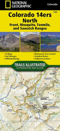
Colorado 14ers North Topographic Map Guide
National GeographicA perfect peakbagger's companion, the Trails Illustrated Colorado 14ers North topographic map guide booklet features details for 14ers of the Front, Mosquito, Tenmile and Sawatch ranges.
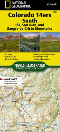
Colorado 14ers South Topographic Map Guide
National GeographicWith details for the 14ers of the Elk, San Juan and Sangre de Cristo ranges, the Trails Illustrated Colorado 14ers South topographic map guide booklet is the perfect peakbagger's companion.

Colorado Collegiate Peaks Wilderness Map
Outdoor Trail MapsWith nine 14ers and a combined 175 miles of trails in one concentrated area, Collegiate Peaks Wilderness offers more than enough playground for adventure seekers and day hikers in central Colorado.

Colorado Comanche Peak Wilderness Map
Outdoor Trail MapsSidestep Rocky Mountain National Park's crowds and explore the cirques, streams and meadows of Colorado's Comanche Peak Wilderness. This map shows the area's hiking trails and is made for trail life.

Colorado Eagles Nest Wilderness Map
Outdoor Trail MapsColorado's 14ers come with a cost: crowds. But you can find plenty of craggy peaks, scrambles and wildlife in the Eagles Nest Wilderness. Design your own adventure with this detailed map.

Colorado Flat Tops Wilderness Map
Outdoor Trail MapsColorado's Flat Tops Wilderness spans a whopping 230,000 acres—the second largest wilderness area in the state. Explore its hundreds of miles of hiking trails with this handy topographic map.

Colorado Greenhorn Mountain/Spanish Peaks Wilderness Map
Outdoor Trail MapsExplore southern Colorado with this topographic map, covering the hiking trails in the Greenhorn Mountain Wilderness and Spanish Peaks Wilderness areas of southern Colorado.

Colorado Holy Cross Wilderness Map
Outdoor Trail MapsSpanning 122,000 acres of the northern Sawatch Range in central Colorado, the Holy Cross Wilderness has many trails to explore. Take this map as your reliable companion and get hiking.
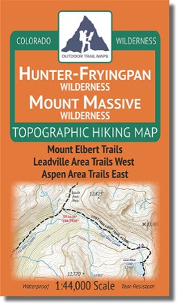
Colorado Hunter-Fryingpan/Mount Massive Wilderness Map
Outdoor Trail MapsDesign your own adventure with this handy topographic map, which covers all hiking trails in the Hunter-Fryingpan and Mount Massive wilderness areas in Colorado's Sawatch Range.

Colorado Indian Peaks/James Peak Wilderness Map
Outdoor Trail MapsWest of Boulder and east of Winter Park, the Indian Peaks and James Peak Wilderness areas span 95,000 acres across Colorado's Front Range. Use this topographic hiking map to design your own adventure.