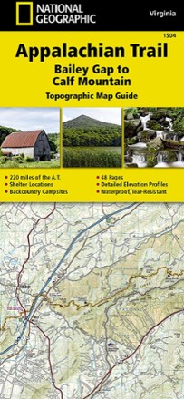
Appalachian Trail: Bailey Gap to Calf Mountain Topographic Map Guide
National GeographicThe National Geographic Appalachian Trail: Bailey Gap to Calf Mountain topographic map guide makes a perfect traveling companion when traversing the central Virginia section of the Appalachian Trail.
North America MapsNew England and Mid Atlantic Maps - DEPRECATED
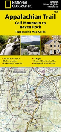
Appalachian Trail: Calf Mountain to Raven Rock Topographic Map Guide
National GeographicInclude the National Geographic Appalachian Trail Calf Mountain to Raven Rock topographic map guide on your list of essentials when thru-hiking the northern Virginia section of the Appalachian Trail.
North America MapsNew England and Mid Atlantic Maps - DEPRECATED
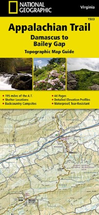
Appalachian Trail: Damascus to Bailey Gap Topographic Map Guide
National GeographicThe National Geographic Appalachian Trail: Damascus to Bailey Gap topographic map guide makes a perfect traveling companion when traversing the southwest Virginia section of the Appalachian Trail.
North America MapsNew England and Mid Atlantic Maps - DEPRECATED
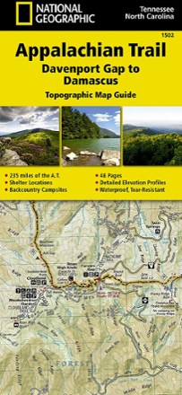
Appalachian Trail: Davenport Gap to Damascus Topographic Map Guide
National GeographicFollow the National Geographic Appalachian Trail: Davenport Gap to Damascus topographic map guide as you take on the northeastern Tennessee and western North Carolina section of the Appalachian Trail.
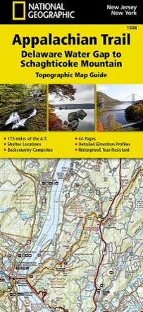
Appalachian Trail: Delaware Water Gap to Schaghticoke Mountain Topographic Map Guide
National GeographicThe National Geographic Appalachian Trail: Delaware Water Gap to Schaghticoke Mountain topographic map guide is a valuable reference for the New Jersey and New York sections of the Appalachian Trail.
North America MapsNew England and Mid Atlantic Maps - DEPRECATED
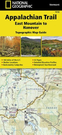
Appalachian Trail: East Mountain to Hanover Topographic Map Guide
National GeographicThe National Geographic Appalachian Trail: East Mountain to Hanover topographic map guide makes a perfect traveling companion when traversing the Vermont section of the Appalachian Trail.
North America MapsNew England and Mid Atlantic Maps - DEPRECATED
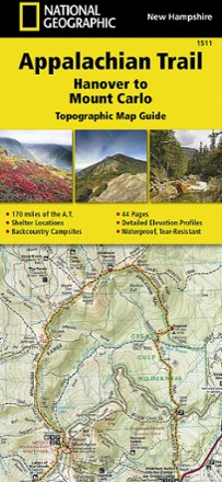
Appalachian Trail: Hanover to Mount Carlo Topographic Map Guide
National GeographicThe National Geographic Appalachian Trail: Hanover to Mount Carlo topographic map guide makes a perfect traveling companion when traversing the New Hampshire section of the Appalachian Trail.
North America MapsNew England and Mid Atlantic Maps - DEPRECATED
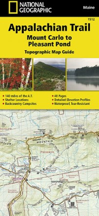
Appalachian Trail: Mount Carlo to Pleasant Pond Topographic Map Guide
National GeographicBring along the detailed National Geographic Mount Carlo to Pleasant Pond topographic map guide when you traverse the southern Maine section of the Appalachian Trail.
North America MapsNew England and Mid Atlantic Maps - DEPRECATED
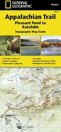
Appalachian Trail: Pleasant Pond to Katahdin Topographic Map Guide
National GeographicThe National Geographic Appalachian Trail: Pleasant Pond to Katahdin Topographic Map Guide makes a perfect traveling companion when traversing the northern Maine section of the Appalachian Trail.
North America MapsNew England and Mid Atlantic Maps - DEPRECATED

Appalachian Trail: Raven Rock to Swatara Gap Topographic Map Guide
National GeographicThe National Geographic Appalachian Trail: Raven Rock to Swatara Gap Topographic Map Guide makes a perfect companion when traversing the southeastern Pennsylvania section of the Appalachian Trail.
North America MapsNew England and Mid Atlantic Maps - DEPRECATED

Appalachian Trail: Schaghticoke Mountain to East Mountain Topographic Map Guide
National GeographicBring the National Geographic Appalachian Trail: Schaghticoke Mountain to East Mountain topographic map guide on your thru-hike of the Connecticut and Massachusetts sections of the Appalachian Trail.
North America MapsNew England and Mid Atlantic Maps - DEPRECATED
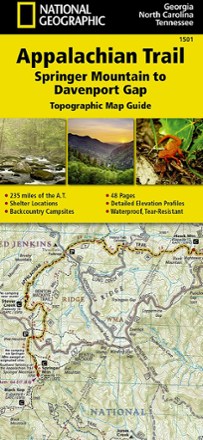
Appalachian Trail: Springer Mountain to Davenport Gap Topographic Map Guide
National GeographicThe detailed National Geographic Springer Mountain to Davenport Gap topographic map guide covers the Georgia, southeastern Tennessee and southwestern North Carolina sections of the Appalachian Trail.
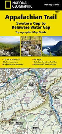
Appalachian Trail: Swatara Gap to Delaware Water Gap Topographic Map Guide
National GeographicBring the detailed National Geographic Appalachian Trail: Swatara Gap to Delaware Water Gap topographic map guide when traversing the northeastern Pennsylvania section of the Appalachian Trail.
North America MapsNew England and Mid Atlantic Maps - DEPRECATED
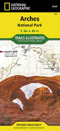
Arches National Park Trail Map
National GeographicThis adventure-ready Trails Illustrated map offers comprehensive coverage of Utah's Arches National Park in colorful, vivid detail.