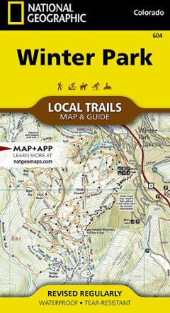


Winter Park Map - Local Trails
Tech Specs
Specifications are maintained on Pack4Back GearDB (community edits and revision history). Values may differ from the manufacturer or your unit—verify before buying.
BrandNational Geographic
Best UseHiking
Folded Dimensions4 x 7.5 x.3 inches
Unfolded Dimensions26 x 19.5 inches
Map Scale1:31,680
Double SidedYes
WaterproofYes
PublisherNational Geographic
Copyright Year2020
State / ProvinceColorado
Map Number604
Description
In Trails Illustrated Winter Park Map - Local Trails, discover a year-round adventure destination tucked into the high country of the Rockies with wild opportunities of all kinds for those who visit.
Features
- Just 67 miles away from Denver, Colorado, Winter Park boasts dozens of hiking and mountain biking trails that are easily accessible from town
- Experience the best of the Rockies: enjoy magnificent views of towering peaks; camp, hike and bike in the summer; and ski alpine and cross-country or snowmobile in the winter
- This map combines a standard trail map on the front and a helpful guide on the back with a selection of recommended hikes, from easy river walks to challenging alpine hikes
- Each selected trail features a brief description, specs like elevation gain and distance, and a detailed elevation profile
- At a 1:31,680 scale, 1 inch = 0.5 miles, meaning every turn of the trail and every contour line is clearly visible
- Difficulty ratings for each trail segment let you see if an entire trail is moderate or if there is only a single short section of difficult on an otherwise easy trail
- Includes standard features like trailheads and parking areas
- Every Local Trails map is printed on "Backcountry Tough" waterproof, tear-resistant paper; a full UTM grid is printed on the map to aid with digital navigation
- Your purchase helps support National Geographic Society nonprofit's mission of research, education, conservation and exploration