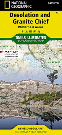


Desolation and Granite Chief Wilderness Areas Topographic Map
Tech Specs
Specifications are maintained on Pack4Back GearDB (community edits and revision history). Values may differ from the manufacturer or your unit—verify before buying.
BrandNational Geographic
Best UseBackpacking
State / ProvinceCalifornia
Folded Dimensions9.25 x 4.25 inches
Unfolded Dimensions37.75 x 25.5 inches
Map Scale1:40,000
Double SidedYes
WaterproofYes
PublisherNational Geographic
Copyright Year2021
Map Number802
Description
If you want to explore more remote corners of the Sierra, the National Geographic Desolation and Granite Chief Wilderness Areas topographic map will aid in your trip-planning and hiking adventures.
Features
- Map covers Desolation and Granite Chief Wilderness areas which are tucked against the west shore of Lake Tahoe in the Sierra of California
- Printed map is arranged so route finding within each wilderness area is as simple as possible
- Entire Granite Chief Wilderness is shown on the front side of the map, and the Desolation Wilderness is shown on the back
- Every trail is classed based on its use including hiking or equestrian, and each trail segment includes a distance so you know how far your travels will take you
- Full UTM grid is printed on the map to aid with navigation
- Printed on Backcountry Tough waterproof, tear-resistant paper