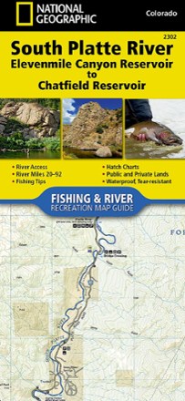
South Platte River Fishing & River Recreation Map Guide: Elevenmile Canyon Reservoir to Chatfield Reservoir
Tech Specs
Specifications are maintained on Pack4Back GearDB (community edits and revision history). Values may differ from the manufacturer or your unit—verify before buying.
BrandNational Geographic
Best UseFishing
State / ProvinceColorado
Folded Dimensions9.25 x 4.25 inches
Unfolded DimensionsUnavailable
Map Scale1:31,680
Double SidedYes
WaterproofYes
PublisherNational Geographic
Copyright Year2017
Map Number2302
Description
A perfect companion for river recreation, the National Geographic South Platte River Fishing & River Map Guide is packed with details and maps to help plan and guide your adventures.
Features
- Covers the South Platte River from just below Elevenmile Canyon Reservoir to Chatfield Reservoir in the southwestern suburbs of Denver
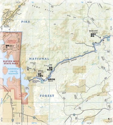
- Includes detailed river maps at a scale of 1 inch to 1/2 mile; at this scale, every turn in the river and rapid is clearly shown and labeled
- Each page is centered on the river and overlaps with the adjacent pages so finding any location along the river is easy
- Maps include river miles, access points, private and public lands, gaging stations, recreation sites and more
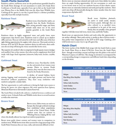
- Also includes stream flow charts, hatch charts and a table of river access points
- Full UTM grids printed on the maps aid with GPS navigation
- Introduction, descriptions of specific fly fishing strategies and notes on seasonal river fluctuations by Colorado fly fishing guide and author Pat Dorsey
- Booklet design is more convenient and easier to use than folded maps, but just as compact and lightweight
- Printed on "Backcountry Tough" waterproof, tear-resistant paper with stainless-steel staples