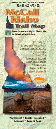

McCall Idaho Trail Map
Tech Specs
BrandAdventure Maps
Best UseMultisport
Folded Dimensions9.75 x 4 x 0.25 inches
Unfolded Dimensions27 x 39 inches
Map Scale1:63,360 & 1:31,680
Double SidedYes
WaterproofYes
PublisherAdventure Maps, Inc.
Copyright Year2019
State / ProvinceIdaho
Description
The McCall area in central Idaho boasts more than 500 miles of public trails. Start exploring them with this handy Adventure Maps McCall Idaho trail map and matching digital map for use on your phone.
Features
- Covers Payette Lake, Loon Lake, Tamarack Resort, Bear Basin Trails, Warm Lake, Payette River, Secesh Summit, Brundage Mountain and Jug Mountain Ranch Trails
- Includes descriptions for 4 hikes, 21 mountain bike rides, 3 gravel rides and 5 paved road rides
- Anglers, hunters and OHV riders will also find this map useful as it accurately shows all streams, lakes, roads, OHV routes and land ownership boundaries
- Thoroughly researched and updated frequently, this easy-to-read topographic (lat/long, UTM grids) map is waterproof, tough, detailed and accurate
- Includes matching digital map for use on phone; no need for cell service to use it once it's been downloaded