Washington Wall Map - Tubed
Tech Specs
Specifications are maintained on Pack4Back GearDB (community edits and revision history). Values may differ from the manufacturer or your unit—verify before buying.
Description
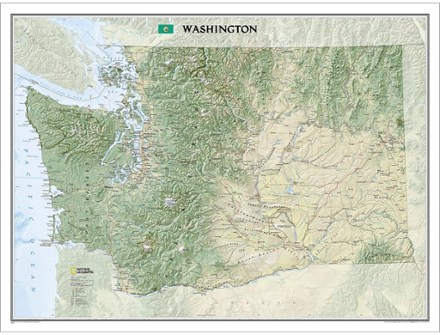
The tubed National Geographic Washington wall map offers a dramatic visualization of the Evergreen State's physical geography. Stunning shaded relief depicts mountains and ocean depths.
Features
- Map locates and names cities, towns, islands airports, national and state parks, military bases, mountains with peak elevations, lakes, rivers and other natural features
- Land cover colorization distinguishes forests and deserts
- 1:652,174 scale
- Printed in the USA on heavy stock paper suitable for framing
- Dimensions: 40.5 x 30.25 in.
- National Geographic Maps; copyright 2015